
Accurate underground pipe location is critical for engineers and construction teams to avoid damaging existing infrastructure, minimize the risk of costly repairs or accidents, and ensure the safety of both the workers and the public during excavation and building projects.
Pipes carrying wastewater, gas, and oil are usually buried underground for safety and aesthetic reasons–but there’s not always a record of where exactly these pipes are laid. This can create challenges when new construction or maintenance work needs to be performed, since there may be uncertainty about their precise locations and depths.
This guide will review the different types of underground pipes, their importance, and how RTK technology assists surveyors and construction workers in quickly mapping large areas such as an agricultural farm or inaccessible areas. We’ll also share the most effective ways of locating underground pipes and answer some popular underground pipe location questions.
Why you’d need to locate underground pipes
In preparation for an excavation, you need to locate underground pipes to avoid damaging essential utilities. Pipe damage can disrupt the flow of water, electricity, and gas to people’s homes. Depending on the type of pipe damaged, the outcome may be much worse. For instance, damaging a gas pipe can cause a gas leak in the area, which could easily cause a fire hazard.
You also need to locate underground pipes in large areas of land, such as an agricultural farm or bare land, to create a digital map of the area—an essential activity for the planning, maintenance, and management of underground installations and pipes.
Locating underground pipes is also important for pipe management. For instance, old underground wastewater pipes may need to be changed, and gas pipes may need to be inspected for leaks. These would not be possible if we couldn’t accurately locate these underground pipes in the first place.
Methods for underground pipe location with utility locators
What are some of the best ways to map underground pipe locations?
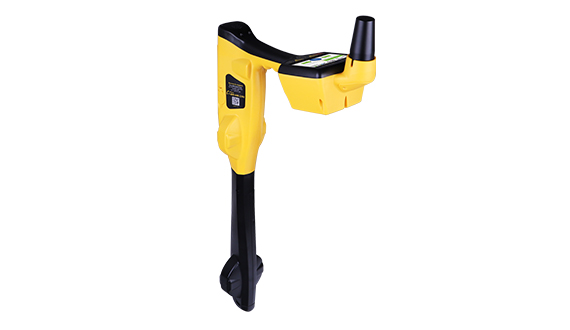
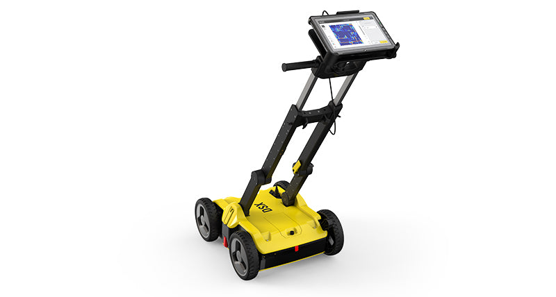
RTK-enabled devices

RTK-enabled underground pipe devices such as drones and survey robots, as well as technologies like geographic information systems (GIS) and building information modeling, can access and accurately collect information on underground pipe locations.
Before RTK, you needed different teams for locating the pipes and then surveying and mapping their locations underground. With RTK, just one person can both locate and map underground pipes quickly, safely, and accurately.
Also, these RTK-enabled devices are best for locating underground pipes in areas where traditional construction surveying methods would be challenging due to the survey environment or its complex terrains, as they can provide real-time GNSS corrections. You can also use NTRIP to enhance the real-time precision of your RTK correction.
Benefits
- Increases the accuracy of underground pipe location to centimeters rather than meters
- It’s easy to implement and interpret
- RTK integrates easily with other survey devices and technologies
- Only need one person to both locate and map the pipes
Limitations
- RTK survey equipment can be expensive
- It’s complex to set up and maintain, especially when you want to build your own RTK
Point One Navigation, however, has an RTK solution—Polaris RTK—that crushes these limitations. Polaris is affordable, starting at $125/mo with a 14-day free trial. It can be set up in 5 minutes by connecting to a single NTRIP mount point, so you don’t have to worry about setup complexity. It also automatically assigns itself to the nearest base and gives you access to local datum.
Start using Polaris with a free trial.
Ground-penetrating radar

GPR pipe locators use penetrating radar pulses to image underground pipes. With GPR, electromagnetic energy is emitted into the ground. When the energy meets an underground pipe, it is scattered back to the surface, and the GPR antenna records the variation in the return signal.
While GPR can be used to locate conductive pipes with electromagnetic energy, since it also measures the variations in energy from subsurface utilities, it can also be used to locate non-conductive utilities. GPR locators can also be improved with inertial navigation systems and GPS.
Benefits
- Effectively locates non-conductive utilities like plastic conduits and concrete sewers
- It’s a non-intrusive option for locating underground pipes
- GPR provides real-time data
Limitations
- Only experienced professionals can interpret the radar feedback
- GPR systems consume a lot of energy
- It’s also not as accurate as RTK
Acoustic method
The acoustic method of locating underground pipes involves harnessing sound waves to pinpoint the location of underground utilities. The device has microphones and sensors that capture acoustic signals from underground pipe content and find differences in the sounds emitted.
Acoustics relies on identifying the difference in sound waves coming from the subsurface. So, the sound would be different if there were an underground pipe. Because of its technique, the acoustic method is effective for locating pipes up to 30 feet deep.
Benefits
- Can locate both metal and plastic pipes
- It doesn’t require excavation
- It can be used together with GPR and electromagnetic locators
Limitations
- The efficiency of the acoustic method is determined by the pressure of the underground pipe content
- Surveyors may encounter pressing differential challenges
- Using the acoustic method for locating underground pipes for be cheap but the results are not as accurate as when you use RTK
Electromagnetic Conductivity

Electromagnetic locators usually have a transmitter and a receiver. The transmitter emits electromagnetic signals into the ground, and when the signal meets with a conductive pipe, such as a metal pipe, the signal pipe is disrupted. The receiver then picks up this alteration and locates its origin in the underground pipe.
Electromagnetic conductivity primarily detects electromagnetic signals, so it works only with conductive utilities such as metal pipes and underground cables. This method of locating underground pipes has been proven effective in desert or arid regions where geophysical surveys are difficult.
Benefits
- Electromagnetic conductivity is a non-invasive technique
- Using electromagnetic conductivity for underground pipe locations results in lower logistics costs
- Operators using electromagnetic conductivity can tell which pipe is which
Limitations
- It can be challenging to locate pipes that are poor conductors of electric and magnetic energy, such as plastic or terra cotta pipes
- Utility depth from electromagnetic equipment are approximation
- The EM method still has limited accuracy compared to RTK-enabled devices
Radio Frequencies
Radiofrequency locators use an electromagnetic field that induces currents in metallic pipes. With radio frequencies, the expectation is that underground metallic pipes would re-radiate signals from a transmitter on the surface. A receiver then detects the frequency released by the metallic pipes to pinpoint the location and depth of the pipes.
However, radio frequencies cannot be used to locate subsurface pipes that cannot react to their frequencies or re-radiate signals, such as non-metallic pipes such as PVC pipes, fiberglass pipes, or concrete pipes.
Benefits
- Best for locating metal pipes and electric cables buried underground
- It is a non-destructive method of locating underground pipes
- It is also cost-effective, especially for initial surveys
Limitations
- Radio frequencies cannot be used to locate pipes that do not respond to electromagnetic induction, such as PVC pipes
- Radio frequencies have limited accuracy compared to RTK
- There’s the risk of coupling into undesired lines due to the choice of signal frequency
Other underground pipe location options
There are other methods of finding underground pipe locations and they include wire tracing, metal detectors, cable locators, and sonde locators,
With wire tracing, a single conductor wire is used to line where the underground utilities are installed. However, each end of the wire is connected to a ground point for traceability. The wires used come in different colors, representing the content of the underground pipes. But for this type of underground pipe location to work, the conductor wire must have been buried with the underground pipe, and the dead-end point is still visible.
Metal detectors basically detect metal underground pipes with magnetic field technology that identifies the presence of subsurface metal pipes. Cable locators and sonde locators work similarly with a transmitter and a receiver. However, while cable locators locate only electric cables and metal conduits from the electromagnetic they emit, sonde locators locate non-metal pipes with small transmitters inserted into them.
How to Locate Underground Pipes
Here’s what you need to know before you start checking for underground pipes and how you can locate underground pipes:
1. Choose the best underground pipe location method
There are many methods for locating underground pipes, but you want an option that allows you to map the location of underground pipes accurately regardless of the material they are built with or what they contain.
The best method for achieving this is with RTK-enabled locators. RTK-enabled locators offer high accuracy of up to one centimeter, with real-time kinematic positioning technology that enhances the precision of satellite-based positioning data and corrects the influence of atmospheric interference on location data.

A super accurate 3D model developed using Point One’s Polaris RTK
2. Understand public vs private utilities
Public utilities are lines that run across highways and sidewalks and are managed by the state or town. Private utilities, on the other hand, are utility lines on private properties. This distinction is important to clarify who is responsible for mapping these utility lines. But if there are public lines in the area, the state will only map these and leave other lines.
3. Create an underground pipe location map of the site
Creating a map of known underground pipe locations and connecting valves is a good starting point. It’ll help guide you through scanning as you’ll basically just be filling in the blanks. Also, you can get existing maps from local councils to guide you.
4. Start scanning
Surveyors can scan for underground pipes in the intended area using any of the methods described in this article. To scan large distances quickly, use GPR and RTK systems to scan for underground pipes.
More About Underground Pipe Locations
Do you still have questions about locating underground pipes? Here, we answer some popular questions about pinpointing underground pipe locations.
What is the easiest way to find underground pipes?
The easiest way to find underground pipes is by using RTK-enabled devices. These devices can pinpoint the location of several types of pipes, from water to oil pipes, with centimeter-level precision.
How do I find an underground waste pipe?
To find an underground waste pipe, you need to use an underground pipe locator that can pinpoint its location based on its material, such as plastic, steel, or PVC. The best method is to use RTK; if you can’t buy one, you can opt for RTK rental services.
What is the best underground utility locator?
The best underground utility locators are RTK-enabled, such as specialized RTK GPS systems that can penetrate dense materials and provide precise location data.
How deep do pipes need to be underground?
The depth of underground pipes is determined by regional laws and the content of the pipe. For example, the standard for water pipes in the United States is 36 inches deep to avoid frosting in the winter. Gas pipes, on the other hand, are buried between 18 to 24 inches deep.
The Safest Way to Locate Underground Pipes
There are various ways to locate underground pipes, and we’ve covered most of them in this article, from RTK-enabled locating devices to locators that use radio frequencies. Among these, the safest way to locate underground pipes is to combine both ground-penetrating radars and RTK correction services. Why?
Thanks to RTK technology, users can pinpoint the exact location of these pipes with centimeter-level accuracy without any invasion.
Don’t know how to choose the best RTK for your locators to pinpoint the location of underground pipes safely? Don’t sweat it. Point One Navigation offers Polaris RTK, a state-of-the-art RTK solution for unparalleled accuracy.
With Polaris RTK, you get centimeter-accurate positioning, lighting-fast convergence times, and 99.99% network uptime.