
It may seem like drones are relatively new technology but believe it or not, unmanned aerial vehicles (UAVs) have been in use in some shape or form for about 100 years. However, there’s no denying that drones are now more easily accessible for organizations and individuals alike.
Real-Time Kinematic (RTK) technology has revolutionized the way businesses use unmanned aerial vehicles (UAVs) across several sectors. From maximizing precision in geospatial data to ensuring accurate path planning, drone RTK technology marks an important advancement in aerial surveying and mapping.
As more businesses adopt RTK drone technology, the unmanned commercial aerial vehicle market is set for rapid growth, from $17.96 billion in 2023 to a projected $21.77 billion in 2024. But what exactly is drone RTK technology, and how can your organization use it to optimize its positioning operations?
How is RTK Used For Drones?
Some of the top applications for drones include mapping, surveying, surveillance, farming, and photography. While these use cases all have unique goals and workflows, they tend to share one common objective: reality determination.
UAVs are particularly helpful for this as they can not only capture imagery but also the imagery’s precise location. Drone operators can then use this positioning data to georeference the image onto the Earth’s surface, transforming the imagery captured into actionable data for their particular use case.
Despite the rise in popularity of drones and the rapid evolution of geospatial technology, achieving high-precision positioning information is not always easy. UAV positioning is typically derived using GNSS, with accuracy that can be impacted by a host of different factors. Correcting these GNSS signal inaccuracies is crucial for drone operators to ensure the information they collect is usable but often complex.
This is where Real-Time Kinematic (RTK) technology plays a key role. A type of differential GNSS (Global Navigation Satellite System), RTK is instrumental in making drone location data more accurate.
Real-time kinematic positioning (RTK) is one method of correcting the GNSS signal inaccuracies of a drone. RTK corrections are essentially derived by calculating the positional discrepancy between a nearby base station and the drone and result in centimeter-level accuracy positioning.
This high-precision positioning not only makes the data captured by the drone more productive but also unlocks further potential for new and innovative use cases.
Standard Surveying vs RTK vs PPK
When it comes to drone operations – especially in tasks requiring high precision like surveying, mapping, and photogrammetry – it’s important to understand the differences between standard surveying, Real-Time Kinematic (RTK), and Post-Processed Kinematic (PPK).
While we’ve reviewed how RTK services could be used for drones, here’s a quick comparison to standard surveying and PPK:
- Standard Surveying: Traditional drone surveying relies on GNSS data to determine the drone’s location. However, this method often results in inaccuracies due to factors like satellite geometry and atmospheric conditions. Standard surveying typically requires ground control points (GCPs): pre-surveyed, known points on the ground used to calibrate and correct the drone’s data post-flight. While effective, this process can be time-consuming and labor-intensive.
- Post-Processed Kinematic (PPK): Similar to RTK, PPK also improves the accuracy of GNSS data but differs in its approach to processing. Instead of correcting the drone’s position in real time, PPK stores all raw GNSS data to be processed after the flight. This method is helpful when real-time correction is not feasible or in areas with poor communication infrastructure. However, PPK still requires some GCPs for validation and it’s recommended to allow 24 hours to pass before post-processing, which won’t work for solutions that need real-time corrections data.
While standard surveying methods are still widely used, drone RTK and PPK technologies have revolutionized drone operations. These technologies offer enhanced precision, efficiency, and flexibility in various applications.
Drones with RTK modules, such as those supported by networks like Point One Polaris, can achieve highly accurate positional data crucial in today’s enterprise and commercial drone operations.
How Accurate is RTK?
By design, RTK significantly improves the accuracy of GNSS data. While standard GNSS systems offer positioning accuracy within a few meters, RTK provides centimeter-level accuracy between 1-3 cm. This dramatic increase is achieved through real-time corrections transmitted from the RTK base station to the drone.
RTK technology corrects several common sources of error in GNSS data. These include ionospheric and tropospheric disturbances, satellite clock inaccuracies, and orbital errors. By addressing these errors in real time, RTK ensures that the positional data gathered by drones is precise and reliable.
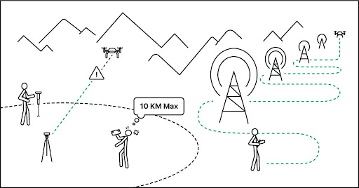
However, the accuracy of RTK is partially contingent on the distance between the drone and the RTK base station. Generally, the closer the drone is to the base station, the more accurate the corrections. That’s why networks like Point One Polaris, with a dense network of base stations, can provide consistent accuracy across larger operational areas.
Point One has over 1,400 base stations across the globe–leading to cm-accurate positioning at 99.99% reliability.
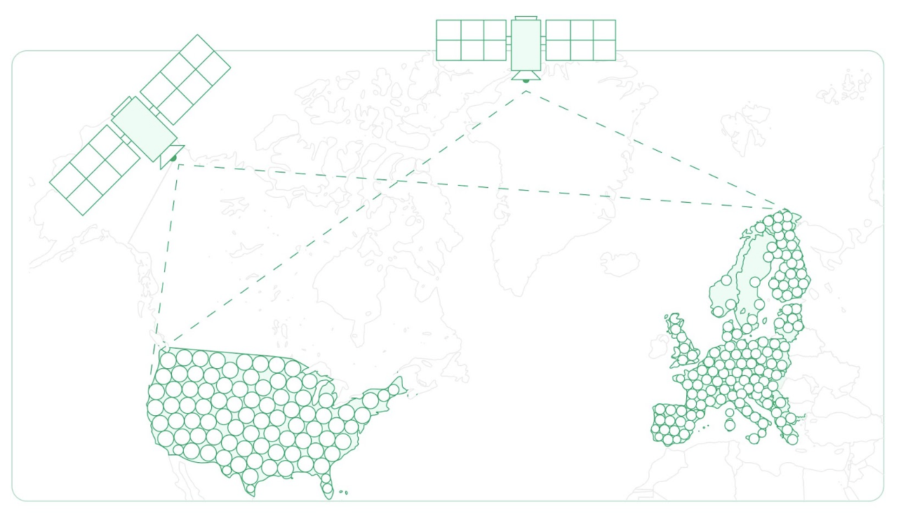
Point One RTK base station density
How RTK Corrects Drone Inaccuracies
RTK technology provides real-time corrections to the GNSS signals received by a drone. These corrections account for a number of errors affecting GNSS accuracy, such as atmospheric interference, signal multipath, and satellite orbit and clock errors.
By comparing the GNSS data from the drone with the data from a known location (the RTK base station), RTK systems can calculate and transmit error corrections to the drone that significantly improve its positional accuracy.
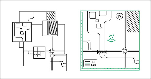
Drone Ground Control Points
Traditional drone surveying and mapping rely heavily on GCPs (ground control points): physical markers on the ground with known coordinates. These GCPs are used to calibrate and correct the drone’s positional data during post-processing. RTK, however, minimizes dependency on GCPs, streamlining the surveying process and reducing the time and labor involved in setting up GCPs.
GNSS Base Station
The GNSS base station also plays an important role in RTK systems. Fixed at a known location and continuously monitoring GNSS signals, the base station calculates the difference between its known position and the position indicated by the GNSS signals. These differential corrections are then transmitted to the drone so it can adjust its positional data in real time.
Current Drone Location
The current location of a drone equipped with RTK technology is calculated by combining the GNSS data it receives with the real-time corrections from the RTK base station. This process provides highly accurate, reliable, and instantaneous positional information, making RTK-equipped drones ideal for precision-demanding applications like construction planning, agriculture mapping, and infrastructure inspection.
Why Your Drone Needs RTK
RTK technology isn’t just an enhancement – it’s a transformative tool for drone operations. Here are some of the reasons why integrating RTK with your drone can be a game-changer.
Eliminate The Need to Set Up Your GCPs
Many drone operators still set up their own GCPs or base stations with known locations so they can later rectify data collected in flight for more accurate positioning. By leveraging a modern RTK network like Polaris, you can simply fly your drone and achieve centimeter-level accuracy by accessing over 1,440 global base stations – all without having to set up your own GCP.
With RTK, you can spend more time collecting and using the data you need, and less time preparing to capture it.
Drastically Reduce Post-Processing Time
Similarly, RTK reduces the amount of time processing data post-flight. Any photogrammetry, LIDAR frame matching, or mapping requires post-processing work on a computer to accurately georeference the data collected and make it usable.
RTK corrections drastically decrease this effort by providing high-precision positioning from the start. For example, a recent case study found that RTK-enabled drones reduce post-processing time by 90%.
Simplify Path Planning and Navigation Workflows
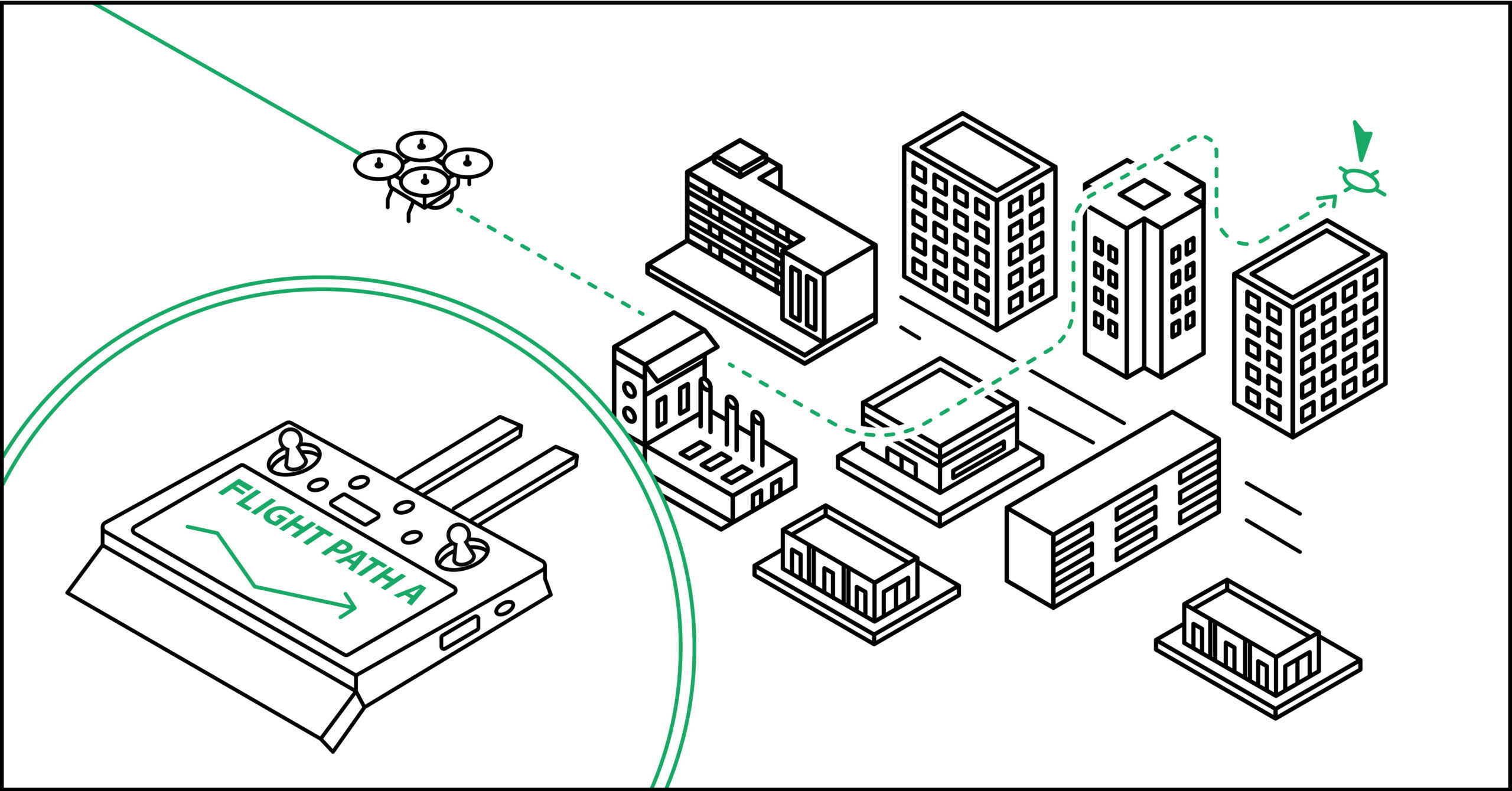
RTK also makes it easy to plan and set up your drone’s flight path. As you prepare to capture data with a UAV, you no longer need to spend time surveying and setting up GCPs to ensure your drone stays on track.
RTK enables your drone to accurately navigate in the real world based on the x, y, and z dimensions of your pre-programmed flight path by correcting any GNSS signal inaccuracies in real-time. Plus, you won’t need to post-process GCP locations.
Confidently Avoid Collisions
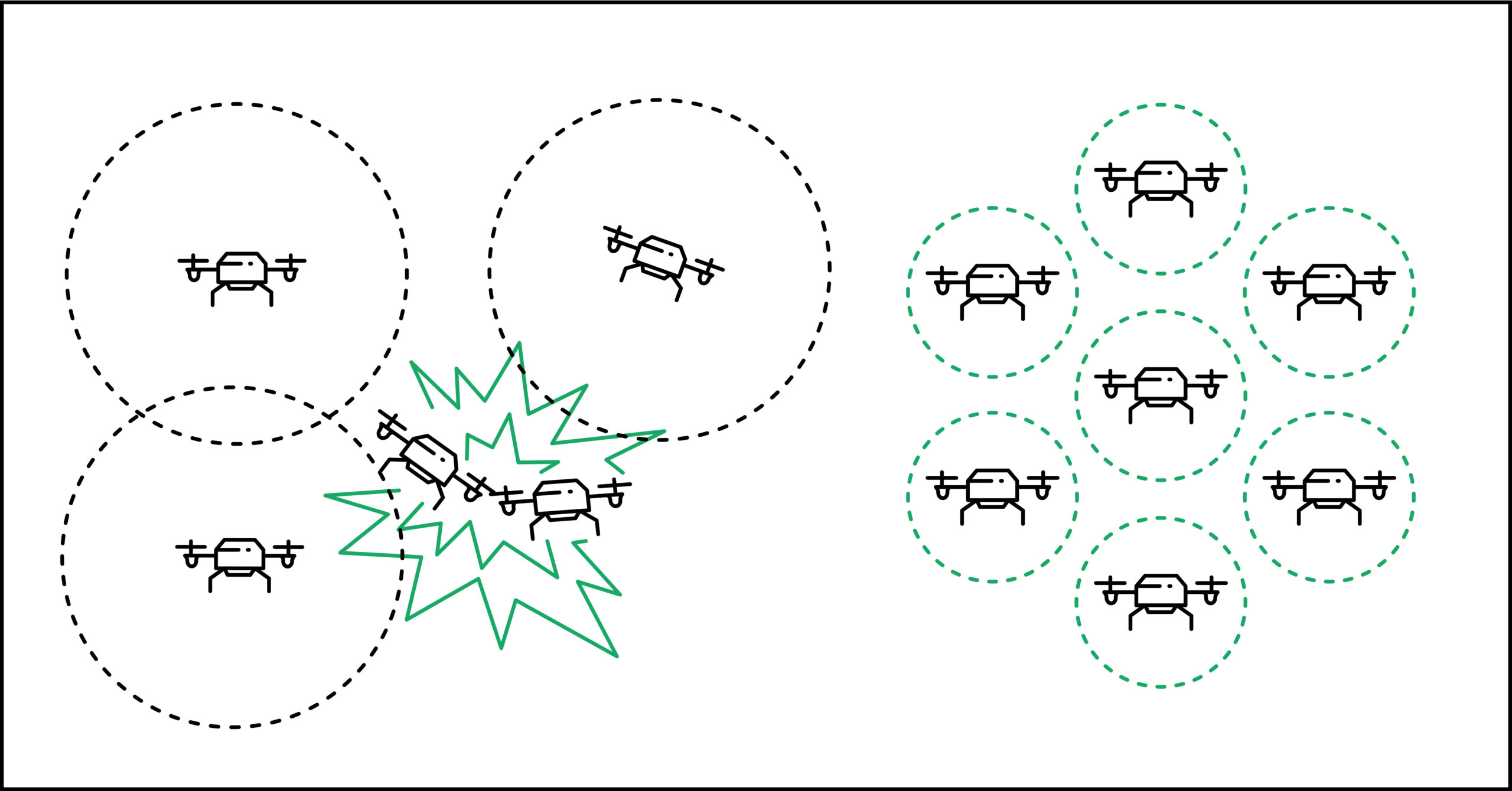
In an increasingly crowded airspace, it’s important to detect and avoid collisions with objects. Whether you’re operating an entire drone fleet or simply trying to avoid a crash, RTK provides the high-precision positioning needed to understand where your UAV is relative to potential obstacles.
Well-functioning RTK integrated with path-planning tools prevents collisions before they happen – read more easily integrating real-time RTK with Point One’s new GraphQL API.
Achieve Unprecedented Observability in Your Flight History

No technical solution is perfect, and while RTK is a game-changer for producing high-precision results, it can also help operators figure out where any remaining inaccuracies are coming from. Properly diagnosing problems that occur in-flight requires observability into flight history, including timestamped locations.
For instance, the GraphQL API makes it possible to send one simple HTTPS request and receive plain, well-formed JSON data in return for any RTK-enabled device, providing an unprecedented level of observability for drone operators.
Expand the Use of Your UAV
All of the time saved and new insights into your drone that RTK delivers mean that you can now explore new and innovative ways to apply UAV-captured data. Every day, new use cases for drones are introduced, and RTK will continue to play an essential role in ensuring high-precision positioning in these expanded applications.
RTK currently powers the foundational positioning data behind precision agriculture, volumetric measurement, inspection, and a host of other location-based use cases.
RTK Drone Applications
The precise positioning capabilities of RTK-equipped drones make them invaluable tools in various sectors. But they’re also paving the way for new uses and innovations. Here are a few of the industries taking advantage of RTK drone applications.
Agriculture
RTK drones are transforming precision farming techniques in the agricultural sector. For instance, they provide more accurate soil health analysis, crop monitoring, and field mapping data. This precision enables farmers to practice site-specific crop management, yield more crops, use resources more efficiently, and reduce environmental impacts.
Mapping & Surveying
RTK drones are also revolutionizing traditional surveying and mapping practices. They facilitate rapid data collection with high accuracy, making them ideal for topographic surveys, GIS data collection, and environmental monitoring. This is particularly beneficial for large-scale and difficult-to-access areas.
Inspections & Public Safety
For inspections and public safety operations, RTK drones provide an efficient and safe way to assess infrastructure like dams, bridges, buildings, and power lines. They also play an important role in emergency response, search and rescue operations, and disaster management, providing accurate and timely aerial perspectives.
Construction
In the construction industry, RTK drones are useful for site planning, monitoring progress, and making sure that projects follow their blueprints. They provide precise data that helps reduce costly errors, ensure compliance with regulations, and enhance overall project efficiency.
Mining
RTK drones are also used for surveying mine sites, monitoring stockpiles, and calculating extracted materials’ volumes. They provide safer and more cost-effective alternatives to traditional survey methods, especially in hazardous and expansive mining environments.
Use the Best RTK Network for Drones
Advancements in RTK technology have been instrumental in making drone operations more precise, efficient, and versatile across various sectors. However, it’s important to note that the efficacy of this technology is significantly impacted by the RTK network it uses. A superior RTK network means broader coverage, consistent accuracy, and reliable performance – essential factors for drone applications from agricultural development to urban development, emergency response, and beyond.
The Point One Polaris network is designed to meet the high demands of modern drone operations. With an expansive coverage area backed by a dense network of base stations, Point One Polaris ensures that your drones receive accurate, real-time positional corrections regardless of their location. Whether you’re conducting detailed surveys, monitoring agricultural lands, or managing construction sites, Polaris from Point One provides the precision and reliability you need.
Discover how Point One Polaris can transform your drone operations. Contact us for more information and take the first step towards integrating the best RTK network into your UAV systems.