
Real-time Kinematic (RTK) positioning continues to shape the landscape for industries requiring high-precision location data–with surveying at the forefront.
An RTK survey employs the latest advancements in communication and navigation satellite technology, provides better accuracy, and reduces the common errors in other surveying techniques. Its application spans diverse fields, including transportation, disaster prevention, and engineering, where precise measurements are critical.
This guide from Point One Navigation explores the complexities of surveying using RTK technology, including how it works, its applications, and the advantages it offers. Professionals requiring the highest accuracy, and efficiency in surveying tasks will benefit from understanding the nuances of this technology.
What is a Real-time Kinematic (RTK) Survey?
Real-time Kinematic (RTK) surveying is a highly advanced form of surveying that provides centimeter-level accuracy. It operates under the Global Navigation Satellite System (GNSS), encompassing various satellite constellations like GPS, GLONASS, Galileo, and BeiDou.
Using RTK in surveying significantly improves the precision of satellite-based positioning by using real-time corrections to address common navigation errors. The term “’real-time” is key since it denotes the system’s capacity to provide corrections instantly.
This capability is vital in applications requiring precise measurements and quick data collection, such as construction, land surveying, agriculture, and various engineering applications.
What is Surveying Like Without RTK?
Surveying is a profession that demands extensive education and field experience. It involves creating detailed, accurate representations of land, where every measurement must be precise. The accuracy levels required can vary significantly across different types of surveying, such as construction versus land surveying. Each has its standards for what constitutes “survey grade” precision.
While surveying without RTK is possible, it introduces complexities and limitations that can hinder precision and efficiency. Surveying without RTK technology is like navigating with a very delayed, somewhat inaccurate compass. Surveyors must rely on traditional surveying methods which often involve the use of theodolites, tapes, and levels. They require multiple measurements and manual calculations: a much slower process that’s prone to human error, leading to less confidence in the accuracy of the final results.
RTK technology, on the other hand, offers real-time, centimeter-level precision. Of course, the reliability and accuracy of your RTK-supported survey will depend on the RTK system you’re using. For ultimate accuracy and reliability, the best solution is working with a professional RTK service.
Point One Navigation’s Polaris RTK network offers unparalleled GNSS accuracy. Surveyors can access cm-accurate positioning on your hardware–even in challenging environments such as urban canyons and occluded sky-views.
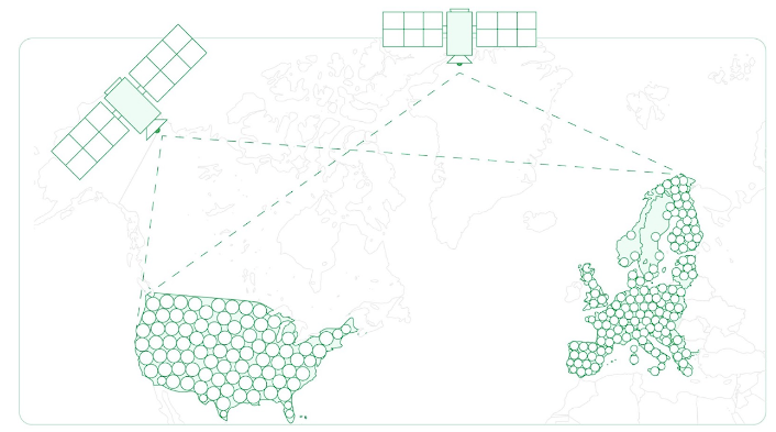
Polaris RTK network
With 99.99% uptime, convergence times of less than five seconds, and a $60 monthly fee, Polaris’ comprehensive RTK network ensures surveyors can rely on the utmost accuracy and convenience for their critical work.
How an RTK Survey Works
An RTK survey relies on principles of satellite positioning combined with real-time data correction to offer a level of precision that traditional GPS methods cannot match. It involves two key components: an RTK base station and an RTK rover.
The base station is a static point with pre-surveyed, known coordinates, continuously monitoring GNSS signals and calculating correctional data. This data, which accounts for errors due to ionospheric and tropospheric disturbances, satellite clock inaccuracies, and orbital errors, is transmitted in real-time to the RTK rover.
RTK Survey Equipment
You can take two primary paths when using an RTK survey system: setting it up yourself or utilizing a professional RTK network provider like Polaris. Each approach has its considerations, especially in terms of complexity, cost, and the level of precision required for your projects.
You can take two primary paths when using an RTK survey system: setting it up yourself or utilizing a professional RTK network provider like Polaris. Each approach has its considerations, especially in terms of complexity, cost, and the level of precision required for your projects.
- Do It Yourself (DIY) RTK Systems: The DIY approach involves purchasing or renting an RTK base station and then installing and calibrating it at your work site. This method might appeal to those looking to cut costs or seeking more control over their survey data. However, a significant challenge lies in the setup and ongoing maintenance. Establishing your own RTK system not only demands a substantial initial investment in equipment but also requires regular updates, calibration, and technical troubleshooting, which quickly becomes time-consuming, expensive, and stressful.
- Using an RTK Network (Polaris): Conversely, leveraging an established RTK network like Point One’s Polaris simplifies the process significantly. With Polaris, you gain access to a comprehensive network of base stations without the burden of setting up and maintaining your equipment. This network provides real-time GNSS corrections, ensuring centimeter-level accuracy across vast areas. Point One’s Polaris system is designed to be compatible with a wide range of hardware, offering flexibility and convenience to users. Integrating with Polaris is seamless whether you’re using specific models like Bad Elf Flex or any survey equipment with NTRIP connections.
The key advantage of opting for an RTK network over a DIY setup is eliminating the need to manage personal base stations for each project. This saves time and resources and enhances the accuracy and reliability of your survey data, thanks to the professional management and constant technological updates provided by services like Point One–all for just $60 a month.
Read more here: Is it worth it to build your own RTK system?
When & Where
RTK surveying is most effective in open spaces with good visibility to the sky, which ensures a clear signal from the GNSS satellites. However, conditions like heavy foliage, urban canyons, or hilly terrain can obstruct the satellite signals, impacting the accuracy of RTK surveying.
Point One Navigation mitigates these potential limitations by using all constellations so they can work with any satellite that has a clear line of site. Of course, if you can’t see enough of the sky to get any GNSS fix, no amount of corrections is going to help. But, RTK helps increase accuracy–even if you have a minimum amount of satellites in view.
When is an RTK Survey Used?
Real-Time Kinematic surveying has become critical in various industries because it provides centimeter-level, real-time accuracy. Its applications range from basic surveying tasks to advanced navigation and mapping.
Damage Prevention
In utility management and construction industries, RTK surveying is invaluable for locating underground assets. Precise mapping of these assets prevents accidental damage during excavation, enhancing safety and efficiency in construction and maintenance projects.
Navigation & Mapping
RTK surveying plays a crucial role in the field of autonomous navigation. For autonomous vehicles, like drones, RTK provides the precise positioning data necessary for safe and efficient operation. In delivery logistics, RTK surveying enables accurate route planning and fleet management, optimizing delivery routes and schedules.
Precision Agriculture
In agriculture, an RTK survey could be used for field mapping, crop monitoring, and precision farming practices. It allows for accurate placement of seeds, fertilizers, and water, leading to increased crop yields and more efficient use of resources.
Construction
RTK surveying is useful in site planning and machine control, it also ensures that structures are built precisely according to their design. This accuracy is critical for the structural integrity of buildings and the safety of personnel.
Preventative Maintenance
RTK surveying is vital in inspecting and maintaining infrastructure such as pipelines. It enables early detection of potential issues like leaks or structural weaknesses, facilitating timely preventative measures. This precise monitoring ensures the longevity and safety of essential infrastructure,
Mining
In the mining sector, an RTK survey is crucial for accurately measuring and monitoring stockpile volumes, ensuring precise management of resources. This technology allows for efficient planning and execution of mining activities, maintaining safety and optimizing costs.
Advantages of RTK Surveying
RTK surveying offers several advantages over traditional surveying methods, particularly when using a reputable RTK service like Point One Navigation. Our advanced technology and network infrastructure provide reliable, accurate, and fast data.
The advantages of using a high-quality RTK service make it a valuable investment for any surveying or geospatial data collection endeavor.
Reduces Human Error
A significant advantage of RTK surveying is its ability to minimize human error. The precision of RTK technology automates and refines the process of capturing spatial data, reducing mistakes caused by manual measurements and/or calculations.
At Point One, we place a significant emphasis on calibration to ensure the highest level of accuracy. This meticulous calibration process is a critical step in our workflow, requiring extensive time and attention to detail. By thoroughly calibrating our RTK systems, we minimize potential discrepancies and provide our clients with reliable, precise surveying results.
Centimeter-Level Survey Accuracy
RTK surveying is renowned for its centimeter-level accuracy. This high degree of precision is essential in applications where even the slightest miscalculation can have significant implications, such as in construction, land development, or precision agriculture.
At Point One, we enhance this precision by continuously calibrating our equipment and systems. Our dedication to accuracy ensures that every project benefits from the highest level of detail and reliability, crucial in industries where precision is not just a benefit but a necessity.
Efficiency & Time Savings
RTK surveying stands out for its remarkable efficiency and time savings, transforming the traditional survey process into a streamlined operation. The immediate availability of precise positional information, thanks to real-time data corrections, enables surveyors to expedite their work significantly.
The traditional approach of setting up and managing your own RTK base station can be incredibly time-consuming. It involves not only the initial setup but also ongoing maintenance, calibration, and troubleshooting, which can detract from the productivity of survey teams. This process often introduces delays, especially in projects where time is of the essence.
Contrastingly, using a ready-to-go RTK network like Polaris changes the game. Imagine arriving at a survey site and simply pulling out your survey equipment (be it a survey stick of another GNSS receiver) and having it connect instantly to a reliable RTK network. This convenience eliminates the cumbersome setup and management of personal base stations, dramatically reducing downtime and boosting productivity by tenfold.
In environments where efficiency is paramount, and schedules are tight, the advantages of leveraging an established RTK network cannot be overstated. Surveyors can focus on their core tasks without the burden of managing technical equipment, making them significantly more productive and ensuring projects stay on track.
Are there any limitations to RTK Surveying?
Like any advanced technological system, an RTK survey has limitations. These challenges, however, can be mitigated through proper planning, the use of quality equipment, and the support of a professional RTK service provider.
Set Up Requirements
Setting up an RTK system involves careful selection of the base station location for optimal signal reception and configuring the system for best performance. It also requires a clear line of sight to the sky, which can be challenging in certain environments.
Another notable limitation is their dependency on internet connectivity to receive corrections, which can be problematic in areas without stable internet.
Expensive & Complex
One of the primary limitations of RTK surveying is the expense and complexity associated with setting up and maintaining the system, especially for those attempting to build their own. The cost of high-quality RTK survey equipment can be significant, and technical expertise is required to operate and maintain the system.
RTK Survey Equipment
Modern, accurate, high-quality survey instruments are necessary for effective RTK surveying. This requirement can be a limitation for individuals or organizations that do not have access to such equipment or the resources to invest in it.
Fortunately, services like Point One Navigation can help mitigate these challenges. Point One is enhancing RTK surveying accessibility by integrating L-band technology, enabling functionality in areas without conventional internet. Our comprehensive service provides advanced RTK technology and simplifies the process, removing the need for individual base station setups at job sites.
Compatible with a broad spectrum of survey equipment, including any NTRIP-connected survey stick, Point One ensures reliable, accurate data through extensive coverage and continuous calibration, significantly reducing the burden on clients to maintain their own RTK infrastructure.
Improve Your RTK Survey Process
Enhancing the effectiveness of an RTK survey involves understanding the technology and leveraging the right resources and expertise. Users must consider various factors, such as the equipment’s quality, the correction data’s reliability, and the expertise behind their chosen service.
Point One Navigation is a leading choice for those looking to elevate their RTK surveying capabilities. We offer state-of-the-art RTK solutions and ensure users can access the latest survey technology. Our services are designed to provide users with precision and efficiency.
To learn more about how Point One Navigation can improve RTK surveying processes and to explore our range of services, contact our team of experts.