
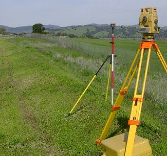
Survey poles and range poles are tools used to ensure that the survey team can obtain location data more precisely while out in the field. These poles come in different lengths, are made of different materials, and are usually painted brightly for visibility over a distance.
In this article, we’ll share how survey sticks and poles work, list some of the best survey and range poles on the market, and explain how you can get best-in-class solutions for positioning accuracy in surveys, from NTRIP services to RTK solutions.
What are Range Poles, Survey Poles, & Prism Poles?
Let’s explain each of these pieces of survey equipment in more detail:
Range Poles
Range poles are survey equipment used to mark and align straight lines, establish survey points, and estimate distance. They are also used in excavation projects and to measure property lines.
Typically made of fiberglass, wood, or metal, range poles are designed for ease of use in various sites. They may also have pointed tips for easy insertion into the ground.
Survey Poles
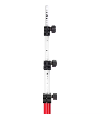
Surveyors primarily use a survey pole to mount survey equipment, such as a GPS device or a prism. They are typically used to mark survey stations, establish sight lines, and provide a precise reference height for measurement.
Some survey poles have adjustable heights, so surveyors can extend the pole’s height when necessary. If you’re using your survey pole with a GPS, you should consider integrating RTK corrections services for more accurate positioning information.
Prism Poles
A prism pole is specifically used for mounting prisms in a survey for precision measurement and data collection. These prisms enhance the accuracy of distance measurements by redirecting the path of the measuring beam.
Prism poles keep prisms above the ground, ensuring that the prism remains stable and at a consistent height for measurement accuracy.
GPS Poles
GPS poles are used for mounting global positioning systems (GPS) to elevate the GPS receiver above ground for better line of sight to satellites, improving the accuracy of location data and reducing obstructions that trees and buildings may cause. They are also often adjustable, so surveyors can increase the length to fit various situations.
Range Rods
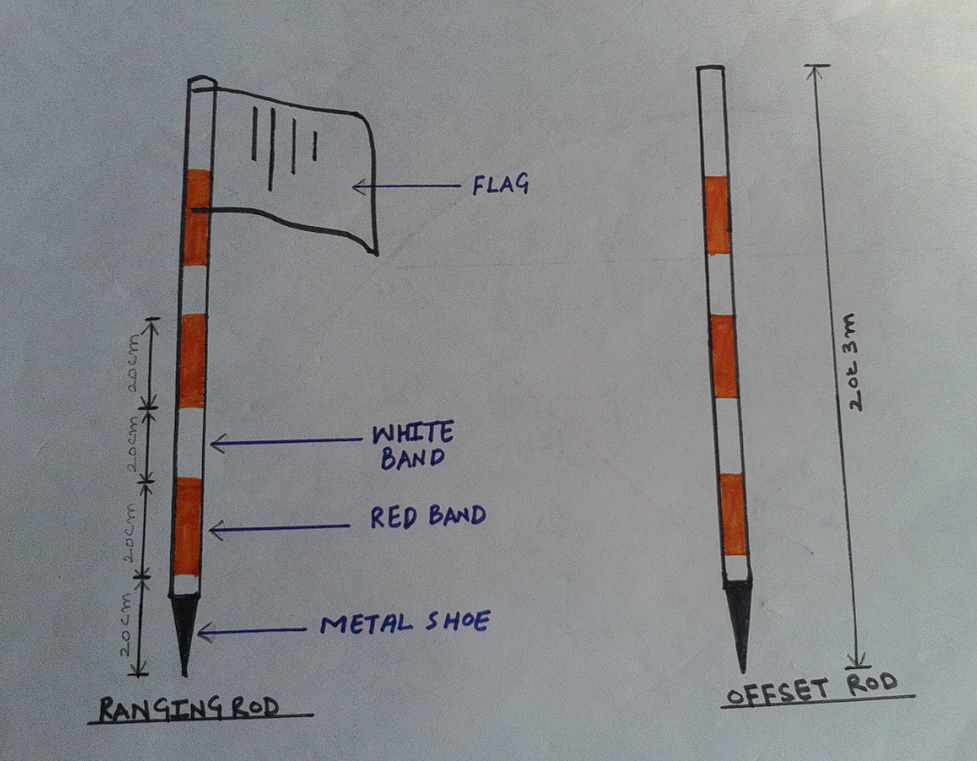
Range rods, also known as ranging poles, are basically range poles longer than 12 feet. The increased length allows for visibility over longer distances and higher terrains. It also ensures that survey team members can maintain high levels of accuracy, especially in expansive areas. Range rods are best for large-scale mapping and surveying on large construction sites.
Regardless of your survey equipment, you need RTK corrections services for precise location data. Point One Navigation’s solution, Polaris RTK, gives you access to over 1400 RTK base stations, <5-second network convergence times, and 99% uptime, giving you centimeter-level accuracy.
Learn more about Point One Navigation’s solutions.
What are Survey Sticks?
A survey stick is a portable rod or pole used to mount a GNSS receiver. Surveyors use it to measure geographical positions in real time with precision. However, this precision can still be improved with RTK correction services.
How Do Survey Sticks Work?
Survey sticks support GNSS receivers, ensuring they are positioned correctly to receive satellite signals. The stick is designed to be stable and long enough to ensure an unobstructed path to receive satellite signals, minimizing errors in location measurement.
Best Range Poles, Survey Poles, & Prism Poles
Here are some of the best range poles, survey poles, and prism poles available on the market, from carbon fiber to aluminum poles.
1. Emlid Survey Pole
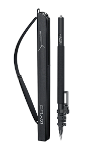
The Emlid survey pole has a three-section construction and flip locks on each section to keep survey equipment steady during use. It also has a smartphone mount, so you can easily use smartphone applications during your survey. The Emlid survey pole is also lightweight, ideal for on-the-go users.
Features:
- Three section construction
- Flip locks for each pole section
- Smartphone mount for mobile devices
- Lightweight pole
Pricing: $299 (tax excl.)
2. Stonex Pole for GNSS
The Stonex Pole is an extendable GNSS pole with a two-section smart design for more compact storage. It is made from carbon fiber, a durable, lightweight material, and can extend up to 2 meters for greater signal reception. The Stonex Pole also has a screw thread for compatibility with Stonex GNSS receivers.
However, its height alone is insufficient to support precise data collection, and users will still need an RTK correction service. While you may consider building your own RTK, it is always best to use a reliable one like Polaris RTK.
Features:
- Extendable GNSS pole
- Two-section design
- Lightweight, durable pole
- 5/8″ screw thread design
Pricing: €264,00
3. Seco Robotics Prism Pole
The Seco Robotics Prism Pole is an extendable carbon fiber pole with centimeter graduation and dual markings on the inner poles in centimeters and feet. It’s also lightweight and durable, and features a pin lock that securely locks the pole in place for stability during surveys.
Features:
- Centimeters and 0.01-foot markings on the inner poles
- Made from carbon fiber
- Pin lock for pole stability
- Extendable height with holes every 0.5 ft
Pricing: $279.99
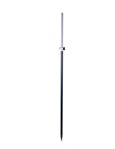
4. Sokkia Range Poles
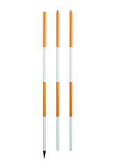
The Sokkia Pole is a range pole with pointed ends that works with any terrain and survey, especially heavy-duty surveying tasks. It has alternating colored bands in white and bright orange so that it’s visible to surveyors even in poor lighting conditions. The 8-foot Sokkia Pole separates into two 4-foot sections for portability, while the 12-foot height separates into three 4-foot sections.
Features:
- Pointed ends for easy insertion into the ground
- Heavy-duty construction
- Alternating orange and white color sections
- Compact design with 4-foot sections
Pricing: $53.75 to $70.50
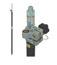
5. Dutch Hill Prism Poles
The Dutch Hill Prism Pole is specifically designed for mounting prisms. It has an adjustable tip and adapter as well as anodized dual graduation marks in inches and centimeters for precise measurement. The Pole features a twist-lock mechanism with an inbuilt bubble vial for stability.
Features:
- Adjustable tip with an adapter
- Anodized dual-graduation marks in both inches and centimeters
- Made of aluminum and a hardened steel point
- Twist lock mechanism with an in-built bubble vial
Pricing: $105.00 to $141.00
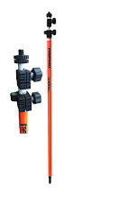
6. SECO Quick Release Two-Piece Rover Rod
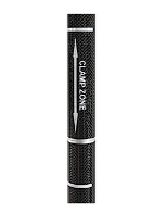
The SECO Quick Release Two-Piece Rover Rod is designed for GNSS applications. It has a two-meter height for increased signal reception and an anti-crush clamp zone to protect the pole from damage during adjustment. It has a push-button for fast and effortless adjustments. If you plan to use your rover rod with a drone, be sure to look into getting a drone RTK to enhance your accuracy and efficiency.
Features:
- Anti-crush clamp zone
- User-friendly design with push-button operation
- Durable and lightweight carbon fiber construction
- Optimized for GNSS apps with a fixed height of 6.56 ft (2.0 m)
Pricing: $321.00
7. Xpert XRTKP Telescopic RTK Pole
The Xpert XRTKP pole is an RTK-compatible telescopic pole that supports GNSS receivers for different survey needs. Made of carbon fiber and aluminum alloy, it is durable and deformation-resistant. It also has clear graduation marks for ease of use and an adjustable length with a lock pin mechanism that allows the pole to be fixed securely at any desired length. The Xpert XRTKP pole is compatible with RTK, so be sure to choose the right RTK to use your Xpert telescopic pole best.
Features:
- Compatible with different RTK systems such as Polaris RTK
- Clear graduation marks for ease of use and readability
- Constructed with high-quality carbon fiber aluminum alloy for durability
- Adjustable length with a lock pin mechanism
Pricing: Buyers have to contact Xpert Survey Equipment, producer of Xpert XRTKP pole, for pricing
8. GPS167 – GPS RTK Rover Rod Survey Pole
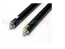
The GPS167 Rover Rod is a lightweight and strong survey pole made of carbon fiber. It has a two-section design that can be assembled together to form a six feet tall pole and a circular level vial for precise antenna alignment and accurate GPS data collection.
The GPS167 Rover Rod can be used with various GPS receiver models and has a 5/8-inch screw thread to support this. This rover rod has a replaceable hardened steel point for durability and optimal performance on different terrains.
Features:
- Made with strong and lightweight carbon fiber material
- 5/8-inch screw thread
- Two-section design that can easily be screwed together to form a single 6-feet pole
- Circular level vial for precise antenna alignment
- Replaceable hardened steel point for durability
Pricing: Buyers have to contact Xpert Survey Equipment for pricing information
Access Ultimate Location Precision For Your Survey
Location precision is crucial in surveying, and achieving the highest level of accuracy often depends on the quality of the equipment used. Whether you are surveying over a short or long distance, you’ll want a survey pole that is durable and long enough. For portability, you should also consider poles with adjustable lengths.
These poles don’t work alone, however; they are used to mount other survey equipment, such as GNSS receivers for drones, mobile mapping systems, and other systems that use inertial navigation for precise positioning and data collection.
Understanding the differences between absolute navigation systems such as Global Navigation Satellite Systems (GNSS), including GPS (Global Positioning System), GLONASS (Global Navigation Satellite System), Galileo, and BeiDou, and relative navigation systems such as Inertial Navigation Systems (INS), odometry used in robotics, and Dead Reckoning, can significantly impact your surveying accuracy and efficiency. However, you can still enhance your precision with GNSS corrections.
Point One Navigation offers best-in-class RTK corrections services for GNSS receivers. With its Polaris RTK Corrections Network, surveyors can access over 1400 RTK base stations, 99.99% uptime, and less than 5 seconds of network convergence time for centimeter-accurate positioning.
Also, Point One Navigation will soon launch a new product: local datums, which will further enhance the accuracy of positioning data.