Global Navigation Satellite System (GNSS) technology is one of the few technologies that has drastically improved how people accurately determine position, velocity, and time for both machines and humans. An important component of this technology is the GNSS receiver that directly receives signals from satellites to provide precise geospatial positioning.
Currently, GNSS receivers are used in several industries, from agriculture for precision farming to transportation to provide users with real-time data for vehicle tracking and routing.
However, GNSS receivers differ based on their ability to navigate common receiver problems such as multipath interference and signal attenuation. For example, some GNSS receivers have anti-interference and anti-magnetic capabilities to limit the impact of external factors on signal accuracy.
This article from Point One Navigation focuses on the industry’s best low-cost, entry-level GNSS receivers that don’t compromise on quality to help you make an informed decision based on your needs.
What are GNSS receivers?
GNSS receivers are devices or software that receive and process signals from GNSS satellites, including GPS, GLONASS, BeiDou, and Galileo, to provide precise geospatial positioning information to users.
For GNSS receivers to work efficiently, they need interoperability, enabling them to receive and process signals from different GNSS satellites, increasing their accuracy.
GNSS receiver vs GPS receiver
The major difference between GNSS and GPS receivers is the satellites they have access to. GPS receivers strictly receive and process signals from only GPS satellites operated by the United States. In contrast, GNSS receivers are compatible with a broader range of satellites, including those operated by Russia(GLONASS), China (BeiDou), Europe (Galileo), and others.
This distinction in coverage means that while GNSS receivers can access all GPS satellites, GPS receivers cannot access other satellites aside from GPS satellites, a limitation that impacts the performance of the device and the accuracy of positioning information offered to users, especially when atmospheric conditions are bad or there is an obstruction in satellite signal paths.
How GNSS receivers work
GNSS software receivers pick up signals from satellites and process them to get accurate information on what is dubbed VPT— velocity, position, and time.
GNSS Receiver Modules
GNSS receiver modules receive signals sent to Earth from orbiting satellites across the globe. These modules have a low-noise amplifier embedded within them to enhance the signal received from satellites since these signals can often be weak.
GNSS Boards
GNSS boards work the same way as a GNSS receiver, but GNSS boards are much larger than GNSS receivers and may include additional data processing or communication features, which simply means an additional process.
GNSS Corrections Services
No matter what GNSS receiver or board you have, you need GNSS correction services. GNSS satellite signals are naturally exposed to technological and other errors that may impact the high accuracy of positioning information. This is where GNSS corrections services come into play, such as RTK and PPP.
Using RTK technology, users receive correction data from a base station, which they can use to correct any GNSS errors. This works as the base station, and the receivers are close in proximity and would have the same errors. RTK corrections can be used on both GPS-enabled devices and GNSS devices.
PPP is globally accessible and counters GNSS errors relating to satellite clock and orbit errors. However, it has reduced accuracy since it only covers two types of GNSS errors and doesn’t make room for atmospheric errors.
For the best location precision, leverage a GNSS correction service like Polaris by Point One Navigation. Polaris gives you affordable global precision for unparalleled cm-level accuracy. With coverage across the EU, US, UK, CA, and AU, it provides users with the ability to access RTK corrections from a single mount point.
Best GNSS Receivers (Entry-Level Options)
Here are some of the best low-cost entry-level GNSS corrections services for you:
1. Emlid REACH RS3
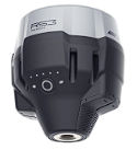
Emlid REACH RS3 is an RTK GNSS receiver with an IMU-based title enablement that allows you to tilt the device up to 60 degrees while maintaining a 20 mm positioning accuracy. Reach RS3 is calibrated at the factory so users can use the device immediately.
It also has several software applications for various tasks, from receiver configuration to data collection.
Software & application compatibility:
Emlid REACH RS3 can use any software that supports RINEX, including Emlid Studio and PPK software for RINEX logging and PPP support.
Features:
- Built-in LTE support
- Connects over the radio with Lora
- Dual-band radio
- Pre-calibrated out-the-box device
- Compatibility with PPP services
2. Emlid REACH RS2
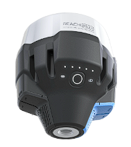
The Emlid REACH RS2 is a waterproof multi-band RTK GNSS receiver with centimeter precision. It has a mobile app for navigation and PPP support, a feature allowing users to access PPP services. With Emlid Reach RS2, users can record raw positioning data in RINEX format. Emlid Reach RS2 can also access signals from all major satellites.
Software & application compatibility:
Emlid REACH RS2 works well with Survey Master and Emlid Flow
Features:
- Waterproof GNSS receiver
- Built-in LTE modem
- 2G/3G fallback modem
- Support for PPP services for centimeter precision
- 22 hours battery life
3. Bad Elf Flex
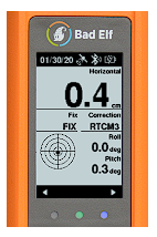
Bad Elf Flex is a portable self-contained Bluetooth GNSS receiver and data logger that offers 1 cm RTK precision via NTRIP which supports surveying in metro locations. Bad Elf Flex also supports the collection of data in locations without cellular coverage with L-band satellite-delivered corrections.
Software & application compatibility:
Bad Elf Flex is compatible with a wide range of apps to be used in several industries from agriculture to aviation and vehicle navigation. These apps include: AgriSite IPM, Terrain Navigator Pro, iFlyGPS, Apglos Survey Wizard, copilot, and TwoNav GPS
Features:
- 11-hour battery life
- Lightweight device can be handheld
- Compatible with iOS, Android, and Windows devices
- Sunlight-readable liquid crystal display
- Supports multiple constellations and frequencies
4. Arrow Gold +
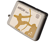
The Arrow Gold + is a Bluetooth GNSS receiver that offers centimeter-level accuracy and access to all four major GNSS constellations. It also supports satellite-based RTK augmentation on both iOS and Android devices for seamless integration with a wide range of mobile applications and software.
Software & application compatibility:
Arrow Gold + is compatible with EOS Tools Pro, a monitoring application with a built-in NTRIP client.
Features:
- Survey-grade accuracy with RTK correction
- Supports all major GNSS constellations
- Device-agnostic GNSS receiver
- Replaceable battery pack
- Supports access to positioning systems software
5. Arrow Gold

Arrow Gold offers 4 cm accuracy with an Atlas subscription. Arrow Gold has an inbuilt SafeRTK for surveying in areas with spotty cell coverage so users have some extra seconds with RTK accuracy before they can reconnect. Arrow Gold also connects to all major GNSS constellations.
Software & application compatibility:
Compatibility with EOS Bridge for multiplexing— streaming the output of third-party sensors to a user’s mobile device via Arrow Gold’s Bluetooth connection.
Features:
- Supports major constellations and GNSS
- 7.5 hours battery life
- Bluetooth connection
- Device-agnostic GNSS receiver
- SafeRTK to retain RTK in areas with poor service
6. South Galaxy G7
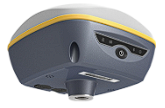
South Galaxy G7 is an LCD touchscreen-enabled RTK receiver with a 5G netcom module that supports 5G communication. Galaxy G7 is based on PPP dial-up technology, supporting real-time dial-up while remaining online.
It can also maintain RTK correction positioning for minutes after the RTK becomes unavailable or interrupted. Galaxy G7 has access to all major GNSS satellites and voice guidance in eight languages.
Software & application compatibility:
The Galaxy G7 RTK receiver is compatible with all domestic CORS applications.
Features:
- LCD touchscreen for convenience
- 5G netcom module for connections
- PPP dial-up technology
- IMU to support tilt effect
- Dual RTK engine algorithm technology
7. Sparkfun RTK Facet
The Sparkfun RTK Facet is a Bluetooth GNSS receiver that supports connection with mobile devices for centimeter-grade measurement. It can be used in four different modes—basic GNSS positioning (rover mode —30 cm accuracy), GNSS positioning with RTK (1.4 cm accuracy), GNSS base station, and GNSS base station with NTRIP server.
Software & application compatibility:
The Sparkfun RTK Facet is compatible with several survey apps such as Field Genius, Survey PC, Survey Master, and Vespucci.
Features:
- Four different modes to fit your needs
- Enclosed design protects the device from debris
- Embedded OLED display
- Bluetooth transceiver
- Supports major constellations and GNSS
What to consider when selecting a GNSS receiver
Here are some things you should consider before you order your GNSS receiver:
Your GNSS corrections service
GNSS correction services support centimeter-level precision for accurate positioning through continuous satellite communication with ground control stations and GNSS receivers. These services go a long way in improving the efficiency of GNSS receivers.
However, some correction services are better than others. So, if you need a reliable, professional, affordable GNSS correction service, you should try Polaris by Point One Navigation.
Polaris by Point One Navigation is a precise location as a service solution that corrects GNSS correction errors, bringing positioning and location data to 1 cm accuracy.
Polaris has over 1400 base stations that send correction signals to RTK receivers, giving you more coverage and better accuracy. With more than 4 base stations each in the top cities in the US, Polaris ensures that you can get accurate positioning data wherever you are.
Polaris can also deliver accurate GNSS corrections over satellites in areas where there is no cellular coverage.
Precision
Since precision is very important in surveying and mapping, choosing a GNSS receiver with high precision is critical.
Different GNSS receivers offer varying levels of precision based on the number of satellites they can access. Additionally, some GNSS receivers have anti-interference capabilities for more accurate positioning.
So when choosing a receiver, look for one that can access several satellites at once from major ones like GLONASS to less known ones like NavIC, and has anti-interference capabilities.
Weight & dimensions
Lightweight GNSS receivers are portable, making them ideal for surveys. However, when buying a GNSS receiver, ensure that it has all the features you need since lightweight receivers could trade off important features for compactness.
However, if your receiver will be stationary, then there’s no need to buy a lightweight GNSS receiver.
Material & durability
Consider receivers with more robust materials and durability features such as water and weather resistance.
Also, consider the device’s battery life if you want to use it for extended hours without having to recharge.
GNSS receiver manufacturer
Some GNSS receiver manufacturers such as Trimble, Swift, and Novatel have built a strong brand over the years on excellence and providing good service. The manufacturer of your GNSS will also influence the type of after-purchase services and support you get, such as warranty.
Tracked constellations
All GNSS receivers track more constellations and can access signals from more satellites than GPS receivers. However, some GNSS receivers track more constellations than others. For starters, ensure that your GNSS receiver can track all the major constellations, such as GPS, GLONASS, BeiDou, and Galileo, as this would increase positioning accuracy.
Also, consider the time to first fix (TTFF), as a faster TTFF means faster location tracking.
GNSS spoofing & jamming resilience
GNSS spoofing and jamming occur when fake signals interfere with a receiver. This is a big problem, especially in niches where security and reliability are important. Some GNSS receivers, however, have anti-spoofing and anti-jamming features, so you should look out for these.
Power & battery life
GNSS receivers with longer battery life and fast charge are more practical to buy for field operations. This would ensure your effectiveness while using your GNSS receiver. Also, consider whether it has power saving mode to extend the battery life when the battery runs low.
GNSS receiver price
In considering the price, include the cost of set up, maintenance, and other routine costs associated with the receiver. And remember, expensive receivers are usually more cost-effective in the long run.
Access Unparalleled GNSS Accuracy
GNSS receivers process signals from satellites to produce data on the velocity, time, and location of devices. However, the precision of these results is affected by a range of satellite and atmosphere-related errors.
To increase the precision of your GNSS receiver, you need unparalleled GNSS correction services like Point One Navigation’s Polaris.
Polaris has over 1400 base stations across the US, EU, and AU, and supports connection to any GNSS-enabled device. It’s built from the ground up for cm-accurate GNSS positioning–at 99.99% reliability.
Even in challenging environments, where competing products fail, Point One’s sensor fusion and signal management deliver consistent accurate location, enabling customers to operate with a high degree of confidence.
