
Drone imagery analysis is a complex undertaking. Believe me, I would know — I spent years doing it for the United Kingdom’s Royal Air Force (RAF). But, with the right tools and expertise to ensure it’s done well, it’s an incredibly useful skill. That’s why, after 23 years in the RAF, I wanted to convert that skill into a useful service for the public and businesses.
I started Sky Eye Imagery, a drone imagery and photography business based in Aylesbury, England, to provide high-quality aerial photography and video services to clients in my part of the U.K. We specialize in aerial inspections of the unseen and hard-to-reach parts of buildings such as roofs and chimneys, and we conduct large-area survey imagery capture and photogrammetry.
In this type of business, attention to detail is absolutely non-negotiable. Clients need complete accuracy when surveying a property, or their images may do more harm than good. From quote to flight plan generation to execution and post-flight processing, Sky Eye Imagery makes precision its primary mission.
The Work of Drone Surveying and Mapping
However, achieving that level of precision with drone surveying is a costly and time-consuming task.
Photogrammetry uses a range of tools and formulas to verify the geospatial location of objects on the ground. Orthorectification, in particular, is a technique that’s required to remove the distortion that topographical changes can cause in drone imagery. This usually requires a set of ground control points (GCPs) and/or post-processing time to ensure all points captured in images can be accurately represented on the maps we create. In the end, this adds hours to the process, not to mention the expense of carrying enough GCPs for our various jobs.
What I really needed to improve my process and results for some clients was a real-time kinematics (RTK) module with an NTRIP server that would keep a stable connection throughout a flight, while being as accurate and affordable as possible. Ultimately, I wanted to see if RTK allowed for geospatial accuracy of within 10 centimeters, as this would allow for a much more streamlined process for orthorectifying drone survey images. When I heard about Point One, it sounded like an ideal solution for this problem — something I could offer my clients that would save them time and money while still ensuring absolute accuracy in drone survey mapping. But I needed to see it for myself to be sure.
Testing RTK Accuracy
For my test, I wanted to compare the accuracy of using a drone with and without the RTK module connected to the Point One NTRIP server. I would run my GNSS-enabled drone and collect images with no GCPs, with and without RTK, to see just how accurate it was in creating orthorectified imagery that had gone through the photogrammetry process.
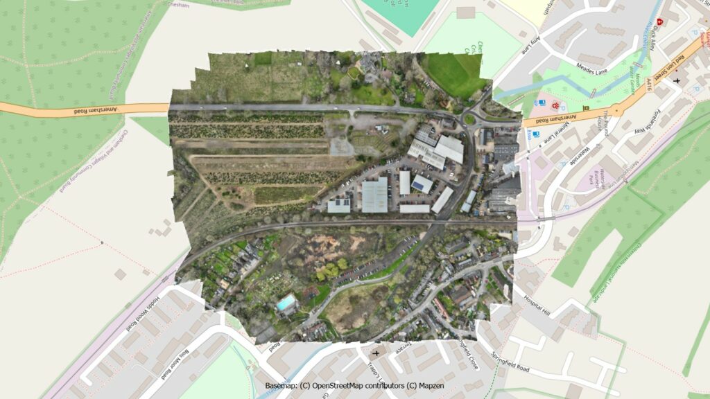
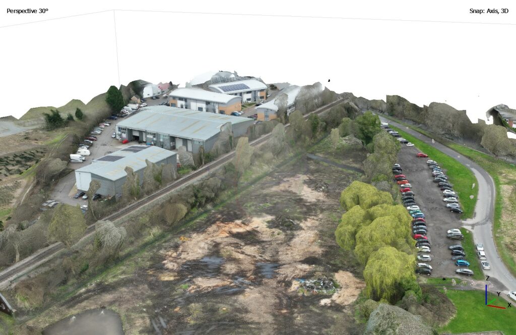
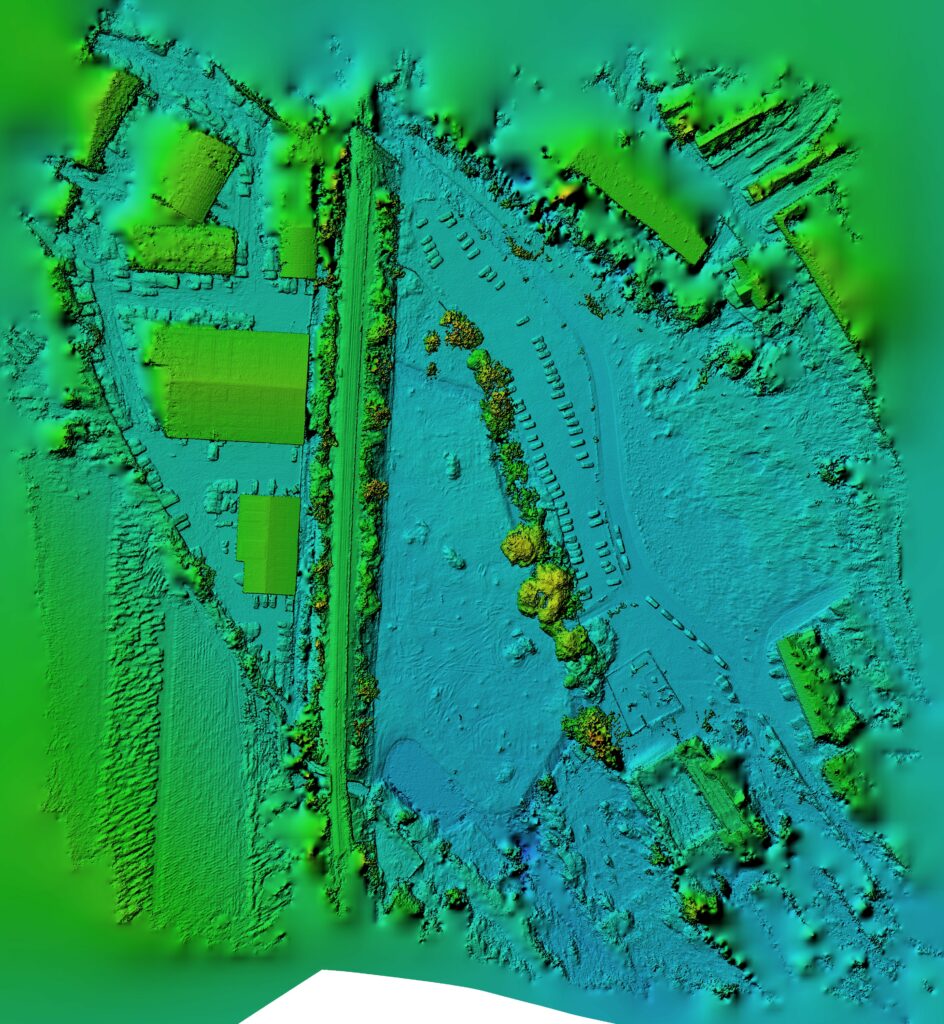
I ran the test in March 2024 at a location in Chesham, England, where I was capturing additional overview imagery for a client. This was the third time I had visited the site, but the first time bringing a survey-capable drone equipped with an RTK module connected to an NTRIP server.
I created a flight plan in advance and uploaded it to the drone on-site. The drone flew for 27 minutes and captured 123 images from oblique angles, which makes geospatial locations especially difficult to verify. Essentially, orthorectification translates the data in these images as if they were taken at near-right angles, directly above the point in question. My big question: Could RTK do this within a 10-centimeter level of accuracy?
Precision RTK Data on Demand
My test results were very impressive for Point One. Based on the error report I generated, the drone with RTK connected was accurate within less than 6 millimeters — a fantastic level of precision well beyond my 10-centimeter target. I could have even refined that accuracy level further by turning on the ultra-high setting for generating geospatial data, but that wasn’t necessary for my client.
In this and other tests, I’ve continued to discover features that make Point One stand out. It’s easy to connect my drone to the RTK network using the login details from the Point One website. From there, I can easily see when I’m connected to the NTRIP server, which allows me to quickly confirm my connection before the survey flight begins and ensure I make the best use of my time.
More than anything, though, I wanted a trusted service that’s always available when I need it, and one that can ensure its data streams are up-to-date and calibrated. Point One has not disappointed, and I’m eager to offer it as an option for my customers.
From the start of the trial period, I was very impressed with Point One’s customer-based service. As a new customer, I had numerous questions that needed clarifying. Its customer service team was superb, providing me with assistance and reassurance that I was utilizing Point One’s data correctly. I look forward to using the service again in the coming weeks.
Want cm-accurate positioning for your robotics? Explore Point One’s Polaris RTK Corrections Network – providing affordable, global precision without the hassle – here.