Geospatial technology is revolutionizing the agricultural industry, offering innovative solutions for tasks ranging from inspection to fertilization and even robotic farming. One of the most prevalent applications in this context is drone-based photogrammetry, which allows farmers to efficiently inspect crops for disease prevention and plant health.

The Problem: Expensive and Complex RTK Solutions
Kevin Curtis, an expert in winery technology and vineyard management, sought ways to leverage drone technology to enhance his clients’ operations. Expanding his wine marketing business into vineyard inspection and operations through technology, he purchased the Mavic 3E drone to scan his clients’ fields. To achieve accurate vine-level mapping, Kevin needed location accuracy of less than 10 centimeters.
At this point, Kevin faced two challenges for achieving precision location. The first option was installing a ground-based base station, which not only involved significant setup but also incurred an additional upfront cost of $4,000. The second option, researching legacy RTK networks, revealed prohibitive costs—almost $500 per month per drone.
The Solution: Affordable and Highly Accurate RTK with Polaris
Kevin initially approached Point One Polaris RTK with skepticism due to the low cost of $50 per month. However, he was pleasantly surprised:
“I couldn’t believe that a service priced at $50 per month could provide the accuracy I needed. Trying out Point One has been a revelation—it’s incredibly accurate and costs a fraction of other services.”
Kevin quickly configured RTK credentials from Point One’s website, enabling precise location data for his Mavic 3E drone. This ease of setup was crucial, given his frequent travels throughout the Okanagan Valley in British Columbia.
“Even in remote areas near mountains in Okanagan, I’ve consistently had a strong RTK signal. Connection has been seamless, with no troubleshooting or issues.
Kevin integrates data from his drones into various tools, including DroneDeploy, Pix4D, MyEVtool, and Sentinel.
The Results: Highly Accurate Drone Scans and AI Disease Detection for Vineyard Clients
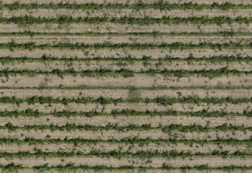
Traditionally, vine inspection and disease prevention required farmworkers to traverse hundreds of acres of fields row by row, a time-consuming task that could take an entire day. The introduction of drones equipped with RTK technology has streamlined this process to a single flight, reducing inspection time to just 30 minutes. Kevin was able to photograph entire fields with the RTK network from Point One and stitch those photos together for highly detailed maps:

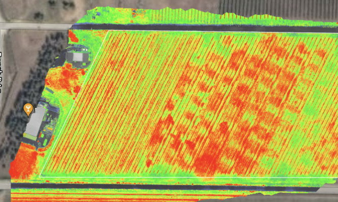
Kevin currently employs Polaris RTK on over 200 acres of vineyard land. He captures orthomosaic and vegetation index photos, delivering high-quality scans to his clients. By leveraging AI-based image recognition software, Kevin identifies common diseases like powdery mildew and pinpoints the specific vines affected, allowing for precise treatment. The image below shows a full vineyard scan for plant health to evaluate irrigation efficiency. Less healthy areas can mean irrigation problems that need to be investigated and fixed.

Polaris is available across the United States, Canada, Western Europe, and Australia. If you are interested in trying RTK for free, sign up today:
