
Geospatial technology is increasingly driving innovation in surveying across a wide range of applications, from watershed management to utility infrastructure development and everything in between. While surveying used to be extremely labor-intensive, requiring manual on-the-ground data collection, drones and LiDAR have made it possible to collect high-precision data more efficiently. However, many surveying teams still experience challenges georeferencing the data collected so it can be used for meaningful mapping and analysis.
At Hubble Creative, we decided to introduce LiDAR technology into our surveying practice, but knew we needed a comprehensive solution to ensure the data we collected was accurately reflected on Earth’s surface. After carefully considering our options, we ultimately selected Point One’s Polaris RTK Network to deliver high-quality, georeferenced data to our clients.
Hubble Creatives is a subsidiary of Naranjo Civil, a civil contracting company that has adopted drone surveying to oversee project advancement. We support various use cases related to structural concrete, utilities, drainage waste projects, and watershed management, among others. To support our clients across this diverse range of projects, Hubble Creative performs aerial, photogrammetry, and LiDAR surveys.
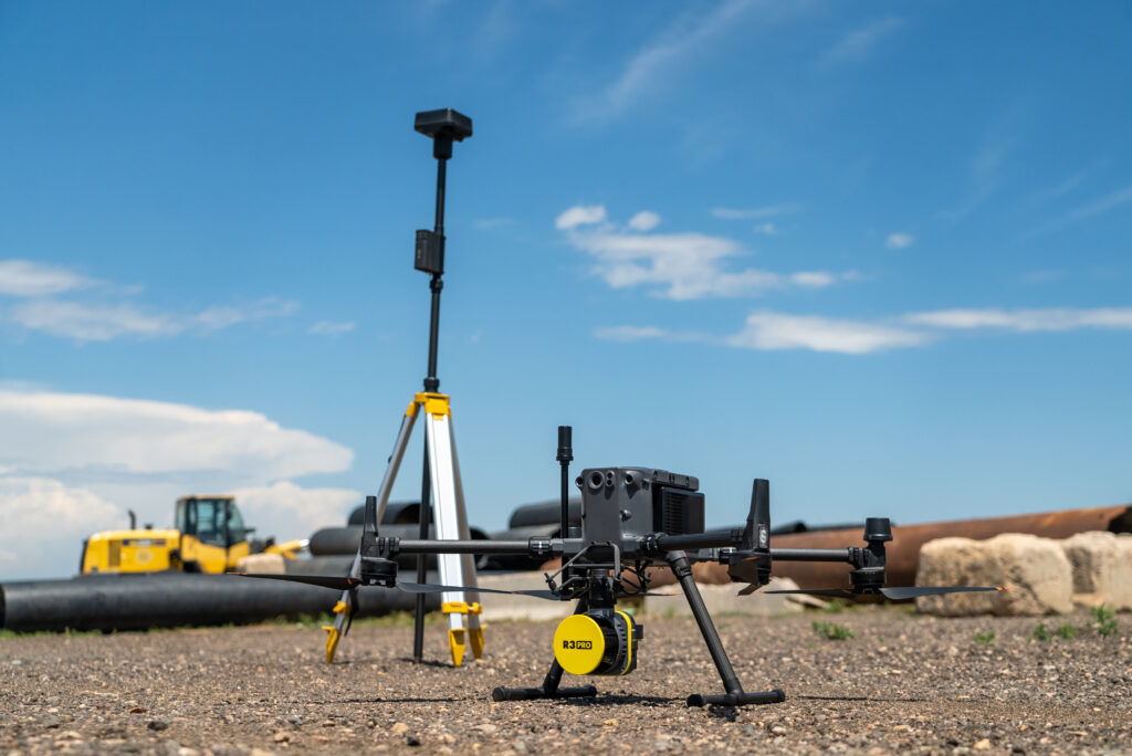
A DJI Matrice 350 drone and a Rock R3 Pro LiDAR sensor, part of Hubble Creative’s aerial surveying tech stack.
Initially, we employed a manual approach involving ground control points and post-processing kinematics (PPK) validation to georeference the data we collected. Our team knew we could augment this with more efficient and accurate positioning, particularly with real-time kinematics (RTK), so we decided to start evaluating options that would help us scale our projects.
Why we chose RTK
Our team knew that RTK would allow us to accurately project the point clouds collected through LiDAR onto real-world latitudinal and longitudinal coordinates in real-time, providing the foundation for our base station’s accurate positioning and GPS capture. While PPK helped us georeference survey data after collection, Hubble Creative was ready to enhance our data capture capabilities with real-time positioning to compare against our PPK baseline to further ensure accuracy.
Why we chose Polaris
The Hubble Creative team looked at a bunch of different options, but Point One always stood out as the top choice. Polaris had two main strengths that we felt were unmatched by other offerings: exceptional accuracy and extensive coverage. First and foremost, Point One’s Polaris RTK network provides centimeter-level accuracy positioning data within a matter of seconds. Additionally, the comprehensive geographic availability of the Polaris RTK network ensures we can georeference the data we’re collecting regardless of where the project site is, something many networks do not have the infrastructure to do. This combination enables our team to georeference data as it’s being collected, enhancing our project efficiency and accuracy.
The result: more efficient & accurate data collection
We’ve now integrated Polaris into our tech stack, which includes a DJI Matrice 350 drone, a Rock R3 Pro LiDAR sensor, and a DJI D-RTK 2 base station. This system enables us to capture precise GPS data during drone flights, which we then cross reference with our existing PPK workflow. Leveraging both RTK and PPK for georeferencing the data we collect helps us provide an added layer of confidence to our survey results, as we can easily identify any inconsistencies between the two positioning systems and correct them accordingly.

A sample of a topographic map generated from our RTK-enabled LiDAR data collection.
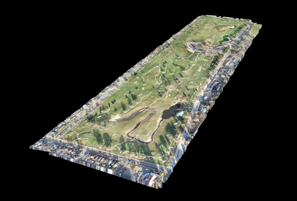
An example of a 3D model produced from georeferenced data collected in a Hubble Creative survey.
Hubble Creative’s adoption of Polaris has transformed our surveying workflow. We were able to seamlessly integrate the Polaris RTK network into our first LiDAR flight and base station setup. It’s very simple to use – once it’s connected, it’s connected, and we can just keep flying and collecting data.
This real-time GPS data collection during drone flights, combined with PPK data, ensures remarkable precision in our client deliverables. We’re excited to see how our team at Hubble Creative can continue to scale our projects in terms of both accuracy and efficiency with the innovative products Point One is developing.
This article was written by guest author Dylan Garcia, Technology & Operations Manager for Hubble Creative.
Interested in how Point One Polaris RTK can transform your surveying workflow? Get in touch here.