

TL;DR: Loosely coupled and tightly coupled describe how deeply a GNSS receiver and an inertial navigation system (INS) share data. In loose coupling, a finished GNSS position is blended with the INS solution. In tight coupling, raw GNSS measurements are fused directly with INS predictions, so the system keeps correcting drift even when fewer than four satellites are visible. Tight coupling is more accurate and more resilient in urban canyons and under canopy, at the cost of greater software complexity, which is why most production systems buy it as a pre-integrated solution rather than building it.
Key takeaways
- Loose coupling fuses a processed GNSS position with the INS output; tight coupling fuses raw GNSS measurements (pseudorange, carrier phase, Doppler) with INS-predicted measurements.
- A loosely coupled system needs a full GNSS position fix (four or more satellites) to aid the INS. A tightly coupled system can use as few as one or two satellites to constrain drift.
- Tight coupling delivers better accuracy and continuity in GNSS-degraded environments, but requires more sophisticated estimation and calibration.
- Adding RTK corrections to either architecture sharpens accuracy; tight coupling plus RTK is the standard for autonomy, robotics, and mapping.
- The complexity of tight coupling is typically handled by a pre-integrated positioning engine rather than built in-house.
Loosely coupled and tightly coupled are the two dominant ways to integrate a GNSS receiver with an inertial navigation system (INS). The difference is not academic. It determines how accurate your position stays when the sky view degrades, how quickly the system recovers after an outage, and how much engineering effort integration demands. This guide explains both architectures as they apply to GNSS/INS, where each fits, and why the choice matters for anyone building precise, reliable positioning.
How GNSS and INS work together
GNSS and INS are complementary because their failure modes are opposite. GNSS measures range to satellites broadcasting their position, then solves for where those ranges intersect. It is an absolute positioning method: accurate over time, with no drift, but dependent on a clear line of sight to enough satellites. In urban canyons, under dense foliage, or indoors, GNSS signals are blocked, reflected, or degraded.
An INS is the inverse. Using an inertial measurement unit (IMU) of accelerometers and gyroscopes, it tracks position, velocity, and orientation relative to a known starting point. It is a relative system that needs no external signal, so it works anywhere, but small sensor errors accumulate into drift over time.
| System | Strength | Weakness |
|---|---|---|
| GNSS | Absolute position, no drift over time | Needs clear sky view; fails in canyons, tunnels, canopy |
| INS | Works anywhere with no external signal | Drifts over time as sensor errors accumulate |
Fuse the two and each covers the other’s weakness: GNSS bounds the INS drift, and the INS bridges GNSS gaps. For the broader design tradeoff, see our guide on absolute vs. relative positioning. The mechanism that combines them is sensor fusion: an estimator (typically a Kalman filter) that builds a physics-based model of the system, predicts expected sensor values, and corrects them against incoming measurements. How deeply that fusion reaches into the GNSS data is exactly what separates loose from tight coupling.
Loose coupling vs. tight coupling at a glance
The defining distinction is the type of information exchanged between the two systems. Loose coupling shares finished solutions. Tight coupling shares raw measurements.
| Loosely coupled | Tightly coupled | |
|---|---|---|
| What’s fused | Processed GNSS position/velocity blended with the INS solution | Raw GNSS measurements (pseudorange, carrier phase, Doppler) fused with INS-predicted measurements |
| Satellites needed to aid INS | Four or more (a full GNSS fix) | As few as one or two |
| Behavior when GNSS degrades | Aiding drops out entirely; INS coasts unaided | Partial measurements still constrain INS drift |
| Accuracy | Good in open sky | Higher, especially in degraded environments |
| IMU calibration | Periodic, from full fixes | Continuous, per-satellite error modeling |
| Complexity | Lower; modular, easier to maintain | Higher; sophisticated estimation and more data to manage |
| Best for | Open-sky applications with a stable sky view | Urban, foliage, and safety-critical autonomy where outages are routine |
Which one should you choose?
- Choose loose coupling if your application operates mostly in open sky, you want a simpler and cheaper integration, and occasional GNSS gaps are acceptable.
- Choose tight coupling if you operate in urban, forested, or safety-critical environments, need centimeter-level accuracy through outages, and want the most resilient solution.
What is loose coupling in GNSS/INS?
Loose coupling blends a GNSS receiver’s finished position and velocity solution with the INS solution. The two subsystems run largely independently: the GNSS receiver computes its own fix, the INS computes its own, and the estimator merges the two outputs. Because the interface is a clean, standardized solution rather than raw signal data, the architecture is modular and comparatively simple to build and maintain.
Benefits of loose coupling
- Simpler to design, integrate, and maintain.
- Modular: components can be developed, tested, and swapped independently.
- Lower integration cost and required expertise.
- Meaningfully improves accuracy over GNSS alone in open-sky conditions.
Limitations of loose coupling
- Requires a complete GNSS fix (four or more satellites) before it can aid the INS.
- When satellites drop below that threshold, GNSS aiding disappears entirely.
- The INS is left to coast unaided in tunnels, urban canyons, and heavy canopy, accumulating drift until a full fix returns.
What is tight coupling in GNSS/INS?
Tight coupling fuses raw GNSS measurements directly with INS-predicted measurements, rather than waiting for a finished GNSS position. Instead of consuming a position solution, the estimator works at the level of individual satellite observations: pseudorange, carrier phase, and Doppler. This is the same architectural idea our engineers describe in the navigation engine deep dive, where the fusion happens on raw measurements in real time and RTK is treated as “just another kind of sensor.”
The consequence is significant. Because tight coupling operates on individual measurements, it can use even one or two visible satellites to constrain the INS error states. A single satellite cannot produce a standalone position fix, but its range measurement still carries information that limits drift along that line of sight. Where a loosely coupled system would lose all aiding, a tightly coupled system degrades gracefully, holding centimeter accuracy on the satellites it can still see and re-fixing faster when the rest return. Our deep dive on how RTK fixing works walks through exactly this partial-fix behavior, from twelve satellites fixed down to a graceful fall back to GNSS plus IMU dead reckoning.
Benefits of tight coupling
- Uses partial GNSS data, one or two satellites, to constrain drift.
- Continuously calibrates the IMU and models error per satellite.
- Rejects reflected or multipath signals that don’t match its prediction.
- Delivers higher accuracy and continuity in GNSS-degraded environments.
Limitations of tight coupling
- Requires sophisticated estimation and careful per-satellite error modeling.
- Manages far more data than loose coupling.
- Changes to one part of the system can ripple into others, demanding more validation.
- Depends on accurate time alignment between IMU and GNSS clocks, one of the most common integration mistakes, as covered in our post on time synchronization in GNSS/INS.
That complexity is the reason most teams buy tight coupling rather than build it.
Where RTK fits in
Both architectures get sharper when you add RTK (Real-Time Kinematic) corrections. RTK improves a coupled system in three steps:
- It uses carrier-phase measurements and reference-station corrections to cancel satellite and atmospheric errors, bringing GNSS from meter-level to centimeter-level.
- It feeds that centimeter-accurate GNSS into the fusion filter, raising the ceiling on the whole solution.
- It speeds recovery after outages, giving the estimator tight constraints for re-resolving ambiguities.
One point worth stressing: with RTK, the density of the correction network, not the coupling method, often governs real-world accuracy, because station spacing determines how well atmospheric errors are modeled. We make the full case in why network RTK density matters.
Atlas: tight coupling as a productized system
The complexity of tight coupling is exactly what a pre-integrated system removes. Point One’s Atlas INS combines an IMU, tightly coupled sensor fusion, and the Point One RTK Network in a single package, delivering real-time, centimeter-accurate position in x, y, z, and attitude without the post-processing workflows tight coupling traditionally required. It is receiver-agnostic at the network level and calibrated out of the box, so teams get the accuracy and resilience of tight coupling without building and validating the estimator themselves.
That combination powers applications from precision agriculture to construction surveying to autonomous robotics, where continuous, reliable positioning through GNSS gaps is a requirement rather than a nice-to-have.
Frequently asked questions
What is the difference between tightly coupled and loosely coupled GNSS/INS?
The difference is the type of data shared between the systems. Loose coupling merges a processed GNSS position with the INS solution. Tight coupling fuses raw GNSS measurements (pseudorange, carrier phase, Doppler) with INS predictions, letting the system correct drift even without a full satellite fix.
Why is tight coupling more accurate?
Tight coupling works at the individual satellite measurement level, so it can use partial GNSS data, one or two satellites, to constrain INS drift. It also calibrates the IMU continuously and models errors per satellite, which improves accuracy and continuity in degraded environments.
When is loose coupling good enough?
Loose coupling is well suited to applications that operate mostly in open sky with a clear satellite view, where a full GNSS fix is almost always available. It is simpler to build, easier to maintain, and less expensive to integrate.
What is the difference between no coupling and loose coupling?
With no coupling, GNSS and INS operate as separate systems that don’t share data. Loose coupling introduces integration: the two run independently but their outputs are fused through a standardized interface to produce a single, more accurate solution.
How does RTK relate to loose and tight coupling?
RTK is a GNSS correction method, not a coupling architecture. It improves the accuracy of the GNSS data feeding either a loosely or tightly coupled system. Tight coupling combined with RTK is the common choice for centimeter-level autonomy and mapping.
Do I need to build a tightly coupled system myself?
Usually not. Tight coupling requires sophisticated estimation, calibration, and validation. Pre-integrated systems such as Atlas deliver tightly coupled GNSS/INS performance out of the box, so teams avoid the engineering overhead.
Get centimeter-accurate positioning
Loose coupling trades accuracy for simplicity; tight coupling trades simplicity for accuracy and resilience. For most precision and autonomy applications, tight coupling plus RTK is the right target, and a pre-integrated engine is the fastest way there.
Start your free trial or contact our team to talk through your integration.
However, the concepts of loose coupling and tight coupling transcend the domain of INS and GNSS integration and find applications across various fields that require system interaction, from agriculture mapping to construction surveying.
Generally, loose and tight coupling refers to the degree of interdependence and interaction between various components or modules within a larger system. Understanding these concepts is essential for designing robust, resilient systems that can evolve and thrive in today’s dynamic and interconnected world.
This article will explore the ins and outs of tight and loose coupling, focusing specifically on applications for INS and GNSS.
What is loose coupling?
In a loosely coupled system, components have minimal dependencies on each other. They can operate independently and communicate through standardized interfaces or protocols. Changes to one component typically have little impact on others, making the system more flexible, scalable, and maintainable. Loosely coupled systems are often preferred in complex, dynamic environments where adaptability and autonomy are crucial.
Take, for example, a web-based e-commerce platform. The front-end interface, back-end server, and database can all operate independently. They communicate through well-defined APIs, allowing developers to modify or upgrade each component without disrupting the entire system. The web at large is considered a loosely coupled system since each component can (and must) be manipulated and monitored on its own.
What is tight coupling?
On the contrary, tightly coupled systems have strong interdependencies between components. Changes to one module often require corresponding modifications in other parts of the system. While tightly coupled systems may offer efficiency and performance advantages in certain contexts, they can be more challenging to maintain and scale. Moreover, they may lack the flexibility needed to adapt to evolving requirements or technologies.
Take, for example, a tightly coupled software system utilized in the field of drone RTK (Real-Time Kinematic) navigation. In such a system, the various components responsible for flight control, GPS positioning, and sensor fusion are intricately linked and communicate closely to ensure precise and accurate navigation for the drone.
Any modifications or enhancements to one component, such as the GPS positioning module, would necessitate corresponding adjustments in other modules, like the flight control or sensor fusion algorithms.
Tight coupling offers many advantages in terms of navigation accuracy and reliability, and in certain fields is essential. Yet due to the technical complexities introduced by tight coupling, changes like upgrading a GPS positioning system or integrating new sensor technologies may require extensive testing and validation across the entire system, thereby making it a complicated endeavor to adapt to evolving requirements or technological advancements.
Luckily, tight coupling for these systems is made accessible due to professional services like Point One that offer pre-calibrated systems and provide ongoing support for users to fully leverage the benefits of tight coupling and sidestep the limitations.
Point One’s Atlas Inertial Navigation System (INS) combines best-in-class hardware with RTK and Sensor Fusion to deliver ground truth precision right from the box. All at a price that allows you to put them in every car/truck/robot in your fleet.
It’s simply the best way to make sure sensors stay in calibration. With Point One you get complete accuracy and precision.
Learn more about Point One Atlas
Loose Coupling vs. Tight Coupling
The distinction between loose and tight coupling lies in the depth of integration and the nature of information exchange between systems.
In loose coupling,
- Components have minimal dependencies on each other
- Changes to one component typically have little impact on others
- Systems are more flexible, scalable, and maintainable
- Are often preferred in complex, dynamic environments where adaptability and autonomy are crucial
In tight coupling,
- Components have strong interdependencies with each other
- Efficiency and performance advantages are found
- Can be more challenging to maintain and scale
- Can lack the flexibility needed to adapt to evolving requirements or technologies
In the rest of this guide, we’ll explore loose and tight coupling as applied to INS and GNSS systems.
How do INS and GNSS work together?
Global Navigation Satellite Systems, or GNSS, works by measuring the range of satellites that broadcast their position in the sky. By precisely calculating where these ranges intersect, users can determine their position on Earth down to a few meters.
This has been the fundamental method for modern satellite-based locations since the first systems went online in the early 1970s. This technique works well in open sky environments because of the direct line of sight to the satellites. However, GNSS signals may be obstructed or degraded in certain conditions like urban canyons, dense foliage, or indoor environments, which lead to inaccuracies or signal loss.
Meanwhile, Inertial Navigation Systems (INS) rely on sensors such as accelerometers and gyroscopes to continuously track the orientation, velocity, and position of a moving object relative to an initial reference point. While INS provides real-time measurements, since it is a relative navigation system, it is prone to inherent errors such as drift over time.
By using the outputs of both an absolute and relative navigation system (GNSS and INS, respectively), GNSS/INS integration yields a far more accurate and robust positioning solution than either system is capable of offering on its own. This integrated approach is widely used in various applications, including navigation for aircraft, ships, autonomous vehicles, and mobile devices, where reliable positioning information is essential for safe and efficient operation.
What is Sensor Fusion?
Sensor Fusion is a sophisticated algorithm that fuses and integrates data from multiple sensors such as GNSS and INS so that they can work together. Sensor fusion can integrate data from satellites, LiDAR, GPS, and cameras to create a comprehensive and accurate representation of the environment or object being monitored. By creating models based on physics, it can predict and correct expected errors in sensor measurement, thereby improving the reliability and accuracy of location information.
Sensor fusion’s ability to blend information from various sensors and incorporate additional contextual data allows users to create a unified framework that enhances the precision of location estimation. Thus, sensor fusion is a critical component in both loose and tight coupling scenarios with integrated navigation systems like GNSS/INSS.
What causes inaccuracy in GNSS systems and why is tight or loose coupling necessary?
In cities, traditional GNSS systems struggle due to signal interference caused by buildings. The signals bounce off the structures creating errors in a process called multipath, distorting their accuracy like a bent tape measure.
Consequently, the GNSS receiver must handle these erratic signals and often resorts to averaging them for display. As the receiver moves, the changing reflection angles further degrade the signal, leading to an unreliable and erratic plot.
As a result, multipath error and its effects cause traditional GNSS signals to be inherently inaccurate in dense urban areas. This creates particular challenges for autonomous land vehicles, necessitating tight and loose coupling.

Take, for example, the signals illustrated above. When the satellite signals bounce off buildings, vehicles, or other surfaces before reaching the receiver, they create errors called multipath. As a result, the receiver might get multiple versions of the same signal at different times, leading to errors in position calculation, as the GNSS receiver resorts to averaging them for display. As the receiver moves, the changing reflection angles further degrade the signal, leading to an unreliable and erratic plot.
Advancements in technology have introduced solutions to mitigate these challenges, such as the use of NTRIP (Networked Transport of RTCM via Internet Protocol). NTRIP allows GNSS receivers to access real-time correction data via the internet. By receiving correction data from reference stations located in optimal positions, GNSS receivers can enhance the accuracy of their positioning solutions, even in urban environments.
To integrate NTRIP with INS/GNSS systems, tight or loose coupling is needed for accuracy, reliability, and precision. Tight coupling and loose coupling help address the challenges by combining the strengths of multiple systems.
What is loose coupling in GNSS & INS?

In the context of GNSS/INS integration, loose coupling involves strategies such as averaging GNSS signals and incorporating data from Inertial Measurement Units (IMUs) and sensor fusion algorithms to enhance navigation accuracy.
As established, GNSS and INS measurements alone carry a degree of uncertainty. Yet when loosely coupled, the degree of uncertainty is greatly diminished, providing highly accurate location information that encompasses parameters such as position, velocity, and attitude from the INS.
Benefits of Loose Coupling
Loose coupling offers a variety of benefits, including simplicity, ease of implementation, and cost-effectiveness. Since loose coupling allows components to operate independently, developers can modify or replace individual components without affecting the entire system. This flexibility makes it easy to adapt to changing requirements or integrate new features.
Due to its modularity, loose coupling is relatively easy to manage and cost-effective. Each component can be developed, tested, and maintained independently without a tremendous amount of technical expertise.
Loose Coupling Limitations
While loose coupling slightly improves navigation accuracy, it may not be sufficient for all scenarios. Loose coupling relies on integrating accelerometer data to calculate velocity and position, which can introduce drift over time due to the averaging of potentially erroneous GNSS data.
This phenomenon compromises the accuracy of the navigation solution, necessitating careful consideration of its application.
What is tight coupling in GNSS/INS?
Another method, known as tight coupling, involves using measurements of aiding signal parameters to mitigate drift in an INS. In comparison to loose coupling, tightly coupled systems are able to update the error states of the INS, even when there is insufficient GNSS data to fix a position.

This can happen when fewer than four GNSS satellites are visible, making it impossible to determine a position solution based solely on GNSS information.
In loosely coupled systems, this situation leads to a complete outage of the data. However, tightly coupled systems can make use of limited GNSS measurements, allowing for partial mitigation of the INS error drift.
To achieve this, tightly coupled systems continuously calibrate the IMU in real-time, particularly when the GNSS signal is unobstructed. This calibration ensures accurate knowledge of the IMU bias and trains the IMU to anticipate the future location of the GNSS signal (anticipatory modeling).
By allowing the IMU to assess the validity and accuracy of the GNSS signal and select the GNSS signal that aligns with its prediction, a tight coupling between the IMU and GNSS can be established.
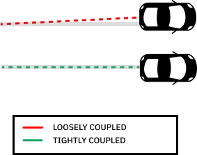
Benefits of Tight Coupling for INS
Essentially, loose and tight coupling differ based on the type of information shared between the individual systems. In loose coupling, a processed GNSS solution is merged with an INS solution; in tight coupling, raw GNSS measurements are combined with INS-predicted measurements.
By actively mitigating drift and leveraging limited GNSS measurements, tightly coupled systems offer improved accuracy and reliability, especially in challenging environments with obstructed or unreliable GNSS signals.
Incorporating RTK into tightly coupled INS/GNSS systems not only enhances positioning accuracy but also improves the system’s overall reliability and robustness, making it an indispensable tool for a wide range of applications, from precision agriculture to autonomous vehicle navigation.
Tight Coupling Limitations
Tightly coupled systems require a sophisticated software design that may involve managing a large number of system data, which can be complex to manage.
Tightly coupled systems are difficult to scale, as adding new components or increasing the size of existing ones often necessitates significant changes to other parts of the system. Moreover, tight coupling may result in more code duplication compared to loosely coupled systems, as components need to communicate more frequently, making maintenance and updates challenging over time.
Finally, tight coupling leads to high dependency among system components because they are highly connected. Consequently, modifications to one component may trigger changes in the other, limiting flexibility and making it challenging to respond to changing requirements. As the system grows in complexity, high coordination among developers becomes essential.
However, this complexity comes with the benefit of being able to extract valuable data from fewer GNSS satellites. By modeling observation errors on a per-satellite basis from calibrations, these systems significantly increase accuracy and reduce data down time.
Fortunately, the limitations of tight coupling can be effectively mitigated with the assistance of professional services such as Point One. Point One offers solutions that have already addressed the complexities of tight coupling, providing users with pre-calibrated systems that offer optimal performance without the need for extensive setup or calibration.
As the first scalable INS with real-time, cm-accurate position in x, y, z, and attitude, Atlas is enabling new applications in autonomy, robotics, and mapping. It’s the world’s most advanced positioning hardware, engine, and RTK network in a single package.
Point One’s team of experts provides ongoing support, allowing users to harness the benefits of tight coupling for INS without encountering any of the associated limitations.
More about Loose Coupling and Tight Coupling
Now that we’ve established an understanding of the many applications of loose coupling and tight coupling, and how they can aid in fusing GNSS/INS data, let’s review the basics.
What is the difference between tight and loose coupling?
Essentially, loose and tight coupling differ based on the type of information shared between the individual systems. In loose coupling, a processed GNSS solution is merged with an INS solution; in tight coupling, raw GNSS measurements are combined with INS-predicted measurements.
What is the difference between no coupling and loose coupling?
No coupling implies the absence of integration or interaction between components within a system. In a system with no coupling, each component operates independently and does not communicate or share data with other components.
On the other hand, loose coupling implies some level of interaction or integration between components, albeit with minimal dependencies. While components in a loosely coupled system can operate independently, they can also exchange data or communicate through standardized interfaces.
What is another name for loose coupling?
Looser coupling is also known as integration-level coupling. This term emphasizes the minimal dependencies between components in a loosely coupled system, where integration occurs at a higher level through standardized interfaces or protocols rather than direct interactions.
What is tight coupling also known as?
Tight coupling is synonymous with deep integration or high cohesion. These terms highlight the strong interdependencies between components in a tightly coupled system, where components share data and resources directly and have a high degree of reliance on each other for operation.
Access Tightly Coupled INS for Ultimate GNSS Accuracy
The distinction between loose and tight coupling lies in the type of information being shared between the individual systems. While loose coupling involves merging a processed GNSS solution with an INS solution, tight coupling integrates raw GNSS measurements with INS-predicted measurements.
Tightly coupled systems require a sophisticated software design that may involve managing a large number of system data, which can be complex to manage.
This complexity, however, comes with the benefit of being able to extract valuable data from fewer GNSS satellites. By modeling observation errors on a per-satellite basis from calibrations, these systems significantly enhance accuracy and minimize data downtime.
The best way of getting all of the benefits of tight coupling by sidestepping the challenges is to rely on the experts at Point One. Point One Atlas has achieved this technological feat while ensuring affordability, thereby making it accessible to the masses.
You can finally titch the complicated and clunky post-processing workflows and get accurate data right from the device. Atlas’ modern web UI and is equipped with on-device and ethernet based streaming of data.